Corral Grande geodata
Corral Grande (Morelos) is a populated place; located in Mexico in America/Mexico_City (GMT-6) time zone. With population of 887 people, there are 9835 cities with bigger population in this country. Compared to other cities in Mexico, 66.3% of cities are located further ↑North; 50.6% of cities are located further ←West and 51.1% of cities have lower elevation than Corral Grande. Note1


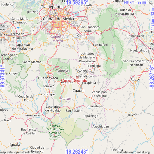
Corral Grande GPS coordinates[2]
18° 55' 44.004" North, 98° 58' 13.008" West
| Map corner | latitude | longitude |
|---|---|---|
| Upper-left | 19.59265°, | -99.67341° |
| Center: | 18.92889°, | -98.97028° |
| Lower-right: | 18.26248°, | -98.26716° |
| Map W x H: | 147.9×147.9 km | = 91.9×91.9mi |
| max Lat: | 32.7° ⇑66.3% North |
| Corral Grande: | 18.92889° |
| min Lat: | ⇓33.7% South 14.53588° |
| min Long | Corral Grande | max Long |
| -117.105° | -98.97028° | -86.73105° |
| W 50.6%⇐ | ⇒49.4% E |
Elevation
Elevation of Corral Grande is 1486 m = 4875 ft, and this is 232.3 m = 762 ft above average elevation for this country.
| Max E: |
3497 m = 11473 ft | 48.9% |
| Corral Grande | 1486 m 4875 ft | |
| Avg. | 1253.7 m = 4113 ft | |
Min E: |
-1 m = -3 ft | 51.1% |
See also: Mexico elevation on elevation.city.
Geographical zone
Corral Grande is located in North Torrid zone (between Equator and Tropic of Cancer). Distance of this Northern Tropic circle is 501.2 km =311.4 mi to North.| Distance of | km | miles | from Corral Grande |
|---|---|---|---|
| North Pole | 7902.4 | 4910.3 | to North |
| Arctic Circle | 5296.5 | 3291.1 | to North |
| Tropic Cancer | 501.2 | 311.4 | to North |
| Equator | 2104.7 | 1307.8 | to South |


Nearby cities:
15 places around Corral Grande: (largest is in red/bold)
• 19 de Febrero de 1812
5.7 km =3.5 mi,  173°
173°
• Cocoyoc
5.1 km =3.2 mi,  193°
193°
• Colonia Puente Pantitlán
2.2 km =1.4 mi,  248°
248°
• Cuauhtempan (San Andrés Cuauhtempan)
5.7 km =3.5 mi,  26°
26°
• El Golán
4.3 km =2.7 mi,  287°
287°
• Emiliano Zapata (Casahuates)
1.2 km =0.7 mi,  81°
81°
• Ignacio Bastida (Santa Catarina Tlayca)
4.8 km =3 mi, 285°
• Itzamatitlán
5.9 km =3.7 mi, 248°
• Las Minas
5.8 km =3.6 mi,  135°
135°
• Lázaro Cárdenas (El Empalme)
5.8 km =3.6 mi,  273°
273°
• Nacatongo
2 km =1.2 mi,  331°
331°
• Oaxtepec
1.9 km =1.2 mi,  129°
129°
• Rancho Cuachixolotera
4.6 km =2.9 mi,  157°
157°
• San Juan Texcalpan
4.4 km =2.7 mi, 79°
• Tlayacapan
3.2 km =2 mi,  338°
338°
Sources, notices
• [Note1] Compared only with cities in Mexico existing in our database
• [Src1] Map data: © OpenStreetMap contributors (CC-BY-SA)
• [Src2] Other city data from geonames.org with taken over terms of usage.
• [Src3] Geographical zone / Annual Mean Temperature by Robert A. Rohde @ Wikipedia
