Colonia Puente Pantitlán geodata
Colonia Puente Pantitlán (Morelos) is a populated place; located in Mexico in America/Mexico_City (GMT-6) time zone. With population of 531 people, there are 15939 cities with bigger population in this country. Compared to other cities in Mexico, 66.5% of cities are located further ↑North; 50.4% of cities are located further ←West and 51.8% of cities have higher elevation than Colonia Puente Pantitlán. Note1
Current local time in Colonia Puente Pantitlán:
06:48 AM, WednesdayDifference from your time zone: hours


Colonia Puente Pantitlán GPS coordinates[2]
18° 55' 17.004" North, 98° 59' 24" West
| Map corner | latitude | longitude |
|---|---|---|
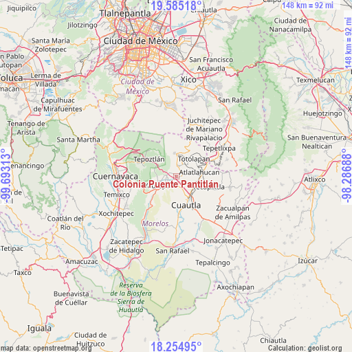
| Upper-left | 19.58518°, | -99.69313° |
| Center: | 18.92139°, | -98.99° |
| Lower-right: | 18.25495°, | -98.28688° |
| Map W x H: | 147.9×147.9 km | = 91.9×91.9mi |
| max Lat: | 32.7° ⇑66.5% North |
| Colonia Puente Pantitlán: | 18.92139° |
| min Lat: | ⇓33.5% South 14.53588° |
| min Long | Colonia Puente | max Long |
| -117.105° | -98.99° | -86.73105° |
| W 50.4%⇐ | ⇒49.6% E |
Elevation
Elevation of Colonia Puente Pantitlán is 1350 m = 4429 ft, and this is 96.3 m = 316 ft above average elevation for this country.
| Max E: |
3497 m = 11473 ft | 51.8% |
| Colonia Puente Pantitlán | 1350 m 4429 ft | |
| Avg. | 1253.7 m = 4113 ft | |
Min E: |
-1 m = -3 ft | 48.2% |
See also: Mexico elevation on elevation.city.
Geographical zone
Colonia Puente Pantitlán is located in North Torrid zone (between Equator and Tropic of Cancer). Distance of this Northern Tropic circle is 502.1 km =312 mi to North.| Distance of | km | miles | from Colonia Puente Pantitlán |
|---|---|---|---|
| North Pole | 7903.2 | 4910.8 | to North |
| Arctic Circle | 5297.3 | 3291.6 | to North |
| Tropic Cancer | 502.1 | 312 | to North |
| Equator | 2103.9 | 1307.3 | to South |


Nearby cities:
15 places around Colonia Puente Pantitlán: (largest is in red/bold)
• Cocoyoc
4.2 km =2.6 mi,  168°
168°
• Colonia Ángel Bocanegra (Adolfo López Mateos)
4.2 km =2.6 mi,  277°
277°
• Corral Grande
2.2 km =1.4 mi,  68°
68°
• El Golán
2.9 km =1.8 mi,  317°
317°
• Emiliano Zapata (Casahuates)
3.4 km =2.1 mi, 72°
• Ignacio Bastida (Santa Catarina Tlayca)
3.3 km =2.1 mi,  309°
309°
• Itzamatitlán
3.7 km =2.3 mi,  248°
248°
• Las Vivianas
4.1 km =2.5 mi,  285°
285°
• Los Arcos
5.2 km =3.2 mi,  223°
223°
• Lázaro Cárdenas (El Empalme)
3.9 km =2.4 mi, 287°
• Nacatongo
2.8 km =1.7 mi,  22°
22°
• Oacalco
4.1 km =2.5 mi,  273°
273°
• Oaxtepec
3.5 km =2.2 mi,  95°
95°
• Rancho Cuachixolotera
5.1 km =3.2 mi,  131°
131°
• Tlayacapan
3.9 km =2.4 mi,  13°
13°
Sources, notices
• [Note1] Compared only with cities in Mexico existing in our database
• [Src1] Map data: © OpenStreetMap contributors (CC-BY-SA)
• [Src2] Other city data from geonames.org with taken over terms of usage.
• [Src3] Geographical zone / Annual Mean Temperature by Robert A. Rohde @ Wikipedia
