Oaxtepec geodata
Oaxtepec (Morelos) is a populated place; located in Mexico in America/Mexico_City (GMT-6) time zone. With population of 6,939 people, there are 1340 cities with bigger population in this country. Compared to other cities in Mexico, 66.6% of cities are located further ↑North; 50.9% of cities are located further ←West and 50.5% of cities have lower elevation than Oaxtepec. Note1


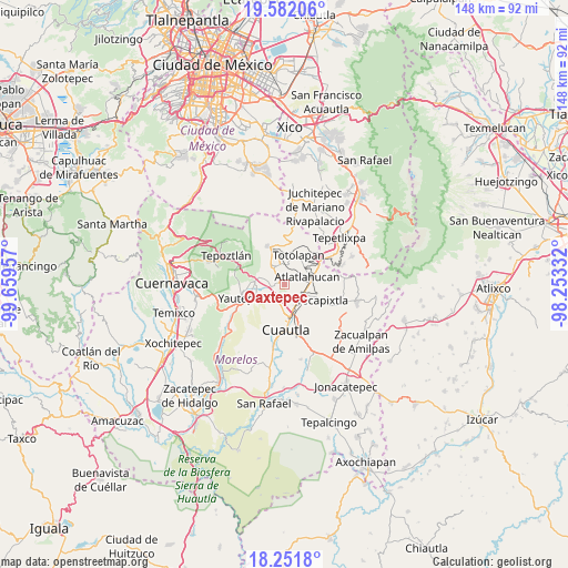
Oaxtepec GPS coordinates[2]
18° 55' 5.7" North, 98° 57' 23.184" West
| Map corner | latitude | longitude |
|---|---|---|
| Upper-left | 19.58206°, | -99.65957° |
| Center: | 18.91825°, | -98.95644° |
| Lower-right: | 18.2518°, | -98.25332° |
| Map W x H: | 147.9×147.9 km | = 91.9×91.9mi |
| max Lat: | 32.7° ⇑66.6% North |
| Oaxtepec: | 18.91825° |
| min Lat: | ⇓33.4% South 14.53588° |
| min Long | Oaxtepec | max Long |
| -117.105° | -98.95644° | -86.73105° |
| W 50.9%⇐ | ⇒49.1% E |
Elevation
Elevation of Oaxtepec is 1461 m = 4793 ft, and this is 207.3 m = 680 ft above average elevation for this country.
| Max E: |
3497 m = 11473 ft | 49.5% |
| Oaxtepec | 1461 m 4793 ft | |
| Avg. | 1253.7 m = 4113 ft | |
Min E: |
-1 m = -3 ft | 50.5% |
See also: Mexico elevation on elevation.city.
Geographical zone
Oaxtepec is located in North Torrid zone (between Equator and Tropic of Cancer). Distance of this Northern Tropic circle is 502.4 km =312.2 mi to North.| Distance of | km | miles | from Oaxtepec |
|---|---|---|---|
| North Pole | 7903.5 | 4911 | to North |
| Arctic Circle | 5297.7 | 3291.8 | to North |
| Tropic Cancer | 502.4 | 312.2 | to North |
| Equator | 2103.5 | 1307.1 | to South |


Nearby cities:
15 places around Oaxtepec: (largest is in red/bold)
• 19 de Febrero de 1812
4.5 km =2.8 mi,  189°
189°
• Cocoyoc
4.6 km =2.9 mi,  215°
215°
• Colonia Puente Pantitlán
3.5 km =2.2 mi,  275°
275°
• Colonia San Francisco
6.1 km =3.8 mi,  113°
113°
• Corral Grande
1.9 km =1.2 mi,  309°
309°
• El Golán
6 km =3.7 mi,  294°
294°
• Emiliano Zapata (Casahuates)
1.4 km =0.9 mi,  349°
349°
• Las Minas
3.9 km =2.4 mi,  138°
138°
• Nacatongo
3.8 km =2.4 mi,  320°
320°
• Narciso Mendoza
5.1 km =3.2 mi,  195°
195°
• Peña Flores (Palo Verde)
5.8 km =3.6 mi, 192°
• Rancho Cuachixolotera
3 km =1.9 mi,  174°
174°
• San Juan Texcalpan
3.5 km =2.2 mi,  55°
55°
• Tierra Larga (Campo Nuevo)
6 km =3.7 mi, 171°
• Tlayacapan
4.9 km =3 mi,  327°
327°
Sources, notices
• [Note1] Compared only with cities in Mexico existing in our database
• [Src1] Map data: © OpenStreetMap contributors (CC-BY-SA)
• [Src2] Other city data from geonames.org with taken over terms of usage.
• [Src3] Geographical zone / Annual Mean Temperature by Robert A. Rohde @ Wikipedia
