Real del Oro geodata
Real del Oro (Veracruz) is a populated place; located in Mexico in America/Mexico_City (GMT-6) time zone. With population of 837 people, there are 10451 cities with bigger population in this country. Compared to other cities in Mexico, 55.7% of cities are located further ↑North; 80.2% of cities are located further ←West and 88% of cities have higher elevation than Real del Oro. Note1


Real del Oro GPS coordinates[2]
19° 25' 26.004" North, 96° 24' 33.012" West
| Map corner | latitude | longitude |
|---|---|---|
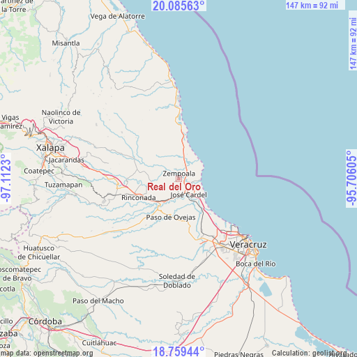
| Upper-left | 20.08563°, | -97.1123° |
| Center: | 19.42389°, | -96.40917° |
| Lower-right: | 18.75944°, | -95.70605° |
| Map W x H: | 147.5×147.5 km | = 91.7×91.7mi |
| max Lat: | 32.7° ⇑55.7% North |
| Real del Oro: | 19.42389° |
| min Lat: | ⇓44.3% South 14.53588° |
| min Long | Real del Oro | max Long |
| -117.105° | -96.40917° | -86.73105° |
| W 80.2%⇐ | ⇒19.8% E |
Elevation
Elevation of Real del Oro is 30 m = 98 ft, and this is 1223.7 m = 4015 ft below average elevation for this country.
| Max E: |
3497 m = 11473 ft | 88% |
| Avg. | 1253.7 m = 4113 ft | |
| Real del Oro | 30 m = 98 ft | |
Min E: |
-1 m = -3 ft | 12% |
See also: Mexico elevation on elevation.city.
Geographical zone
Real del Oro is located in North Torrid zone (between Equator and Tropic of Cancer). Distance of this Northern Tropic circle is 446.2 km =277.3 mi to North.| Distance of | km | miles | from Real del Oro |
|---|---|---|---|
| North Pole | 7847.3 | 4876.1 | to North |
| Arctic Circle | 5241.4 | 3256.9 | to North |
| Tropic Cancer | 446.2 | 277.3 | to North |
| Equator | 2159.7 | 1342 | to South |


Nearby cities:
15 places around Real del Oro: (largest is in red/bold)
• Cabezas
6.4 km =4 mi,  154°
154°
• El Arenal
3.6 km =2.2 mi,  85°
85°
• El Chalahuite
6.6 km =4.1 mi,  34°
34°
• El Palmar
4.5 km =2.8 mi,  209°
209°
• El Paraíso (La Charca)
5.7 km =3.5 mi,  84°
84°
• El Zapotito
4 km =2.5 mi,  312°
312°
• Hornitos
4.3 km =2.7 mi,  343°
343°
• Infonavit el Pando I
3.8 km =2.4 mi,  135°
135°
• Jareros
7.2 km =4.5 mi,  290°
290°
• José Guadalupe Rodríguez (Despoblado)
0.6 km =0.4 mi,  249°
249°
• La Gloria
0.8 km =0.5 mi,  70°
70°
• Loma de San Rafael
6.9 km =4.3 mi,  101°
101°
• San Isidro
7.2 km =4.5 mi, 25°
• Villa Zempoala
2.3 km =1.4 mi,  3°
3°
• Úrsulo Galván
5.5 km =3.4 mi,  112°
112°
Sources, notices
• [Note1] Compared only with cities in Mexico existing in our database
• [Src1] Map data: © OpenStreetMap contributors (CC-BY-SA)
• [Src2] Other city data from geonames.org with taken over terms of usage.
• [Src3] Geographical zone / Annual Mean Temperature by Robert A. Rohde @ Wikipedia
