Hierba de Matancillas geodata
Hierba de Matancillas (Jalisco) is a populated place; located in Mexico in America/Mexico_City (GMT-6) time zone. With population of 799 people, there are 10920 cities with bigger population in this country. Compared to other cities in Mexico, 83.3% of cities are located further ↓South; 78.8% of cities are located further →East and 81.6% of cities have lower elevation than Hierba de Matancillas. Note1
Current local time in Hierba de Matancillas:
08:35 AM, WednesdayDifference from your time zone: hours


Hierba de Matancillas GPS coordinates[2]
21° 51' 55.008" North, 101° 40' 23.988" West
| Map corner | latitude | longitude |
|---|---|---|
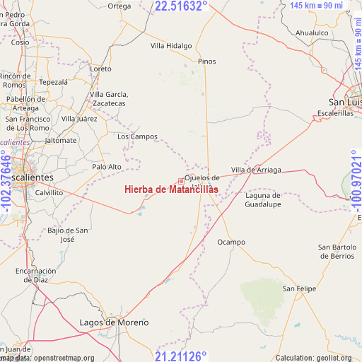
| Upper-left | 22.51632°, | -102.37646° |
| Center: | 21.86528°, | -101.67333° |
| Lower-right: | 21.21126°, | -100.97021° |
| Map W x H: | 145.1×145.1 km | = 90.2×90.2mi |
| max Lat: | 32.7° ⇑16.7% North |
| Hierba de Matancillas: | 21.86528° |
| min Lat: | ⇓83.3% South 14.53588° |
| min Long | Hierba de Matan | max Long |
| -117.105° | -101.67333° | -86.73105° |
| W 21.2%⇐ | ⇒78.8% E |
Elevation
Elevation of Hierba de Matancillas is 2180 m = 7152 ft, and this is 926.3 m = 3039 ft above average elevation for this country.
| Max E: |
3497 m = 11473 ft | 18.4% |
| Hierba de Matancillas | 2180 m 7152 ft | |
| Avg. | 1253.7 m = 4113 ft | |
Min E: |
-1 m = -3 ft | 81.6% |
See also: Mexico elevation on elevation.city.
Geographical zone
Hierba de Matancillas is located in North Torrid zone (between Equator and Tropic of Cancer). Distance of this Northern Tropic circle is 174.7 km =108.6 mi to North.| Distance of | km | miles | from Hierba de Matancillas |
|---|---|---|---|
| North Pole | 7575.9 | 4707.4 | to North |
| Arctic Circle | 4970 | 3088.2 | to North |
| Tropic Cancer | 174.7 | 108.6 | to North |
| Equator | 2431.2 | 1510.7 | to South |


Nearby cities:
15 places around Hierba de Matancillas: (largest is in red/bold)
• Chinampas
15 km =9.3 mi,  257°
257°
• El Sitio
14.1 km =8.8 mi,  38°
38°
• Francisco Primo de Verdad (Ciénega de Mata)
20.7 km =12.9 mi,  229°
229°
• Gachupines
16.2 km =10.1 mi,  134°
134°
• Guadalupe Victoria
19.1 km =11.9 mi,  162°
162°
• Jaula de Abajo
20 km =12.4 mi,  24°
24°
• La Paz
11.2 km =7 mi,  240°
240°
• La Presa
17.7 km =11 mi, 235°
• La Presita
11.6 km =7.2 mi, 23°
• Matancillas (San Isidro Matancillas)
3.6 km =2.2 mi, 40°
• Ninguno [Granja]
8.1 km =5 mi,  290°
290°
• Ojo de Agua de la Palma
16.4 km =10.2 mi,  340°
340°
• Ojuelos de Jalisco
8.3 km =5.2 mi,  89°
89°
• Santa Elena
21 km =13 mi,  53°
53°
• Vaquerías
11 km =6.8 mi,  169°
169°
Sources, notices
• [Note1] Compared only with cities in Mexico existing in our database
• [Src1] Map data: © OpenStreetMap contributors (CC-BY-SA)
• [Src2] Other city data from geonames.org with taken over terms of usage.
• [Src3] Geographical zone / Annual Mean Temperature by Robert A. Rohde @ Wikipedia
