Chinampas geodata
Chinampas (Jalisco) is a populated place; located in Mexico in America/Mexico_City (GMT-6) time zone. With population of 1,881 people, there are 4622 cities with bigger population in this country. Compared to other cities in Mexico, 83.2% of cities are located further ↓South; 79.8% of cities are located further →East and 79.2% of cities have lower elevation than Chinampas. Note1


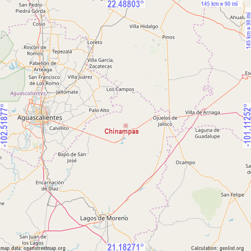
Chinampas GPS coordinates[2]
21° 50' 12.696" North, 101° 48' 56.304" West
| Map corner | latitude | longitude |
|---|---|---|
| Upper-left | 22.48803°, | -102.51877° |
| Center: | 21.83686°, | -101.81564° |
| Lower-right: | 21.18271°, | -101.11252° |
| Map W x H: | 145.1×145.1 km | = 90.2×90.2mi |
| max Lat: | 32.7° ⇑16.8% North |
| Chinampas: | 21.83686° |
| min Lat: | ⇓83.2% South 14.53588° |
| min Long | Chinampas | max Long |
| -117.105° | -101.81564° | -86.73105° |
| W 20.2%⇐ | ⇒79.8% E |
Elevation
Elevation of Chinampas is 2122 m = 6962 ft, and this is 868.3 m = 2849 ft above average elevation for this country.
| Max E: |
3497 m = 11473 ft | 20.8% |
| Chinampas | 2122 m 6962 ft | |
| Avg. | 1253.7 m = 4113 ft | |
Min E: |
-1 m = -3 ft | 79.2% |
See also: Mexico elevation on elevation.city.
Geographical zone
Chinampas is located in North Torrid zone (between Equator and Tropic of Cancer). Distance of this Northern Tropic circle is 177.9 km =110.5 mi to North.| Distance of | km | miles | from Chinampas |
|---|---|---|---|
| North Pole | 7579 | 4709.4 | to North |
| Arctic Circle | 4973.1 | 3090.1 | to North |
| Tropic Cancer | 177.9 | 110.5 | to North |
| Equator | 2428 | 1508.7 | to South |


Nearby cities:
15 places around Chinampas: (largest is in red/bold)
• Cuautitlán
19.4 km =12.1 mi,  234°
234°
• Francisco Primo de Verdad (Ciénega de Mata)
10.3 km =6.4 mi,  186°
186°
• Hierba de Matancillas
15 km =9.3 mi,  77°
77°
• La Paz
5.4 km =3.4 mi,  115°
115°
• La Presa
6.8 km =4.2 mi,  179°
179°
• La Punta
13.3 km =8.3 mi,  257°
257°
• La Troje
14.8 km =9.2 mi,  217°
217°
• Las Negritas
18.1 km =11.2 mi,  339°
339°
• Los Azulitos
15.5 km =9.6 mi,  273°
273°
• Matancillas (San Isidro Matancillas)
18 km =11.2 mi,  70°
70°
• Montoya
17.7 km =11 mi,  285°
285°
• Ninguno [Granja]
9.3 km =5.8 mi,  49°
49°
• Palo Alto
17.8 km =11.1 mi,  300°
300°
• Tacubaya
16.4 km =10.2 mi,  246°
246°
• Vaquerías
18.4 km =11.4 mi,  114°
114°
Sources, notices
• [Note1] Compared only with cities in Mexico existing in our database
• [Src1] Map data: © OpenStreetMap contributors (CC-BY-SA)
• [Src2] Other city data from geonames.org with taken over terms of usage.
• [Src3] Geographical zone / Annual Mean Temperature by Robert A. Rohde @ Wikipedia
