El Sitio geodata
El Sitio (Zacatecas) is a populated place; located in Mexico in America/Mexico_City (GMT-6) time zone. With population of 1,427 people, there are 6051 cities with bigger population in this country. Compared to other cities in Mexico, 83.9% of cities are located further ↓South; 78.1% of cities are located further →East and 82.1% of cities have lower elevation than El Sitio. Note1


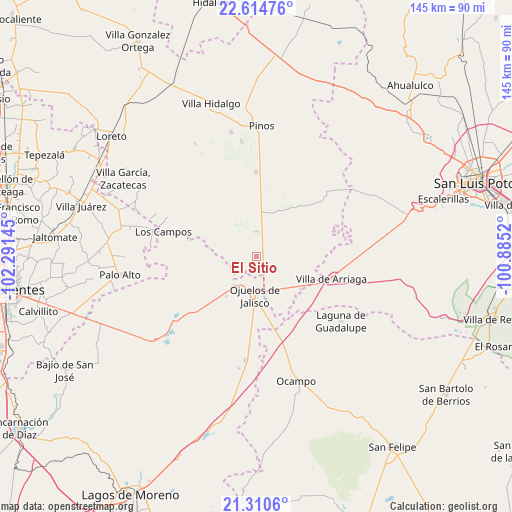
El Sitio GPS coordinates[2]
21° 57' 51.048" North, 101° 35' 17.952" West
| Map corner | latitude | longitude |
|---|---|---|
| Upper-left | 22.61476°, | -102.29145° |
| Center: | 21.96418°, | -101.58832° |
| Lower-right: | 21.3106°, | -100.8852° |
| Map W x H: | 145×145 km | = 90.1×90.1mi |
| max Lat: | 32.7° ⇑16.1% North |
| El Sitio: | 21.96418° |
| min Lat: | ⇓83.9% South 14.53588° |
| min Long | El Sitio | max Long |
| -117.105° | -101.58832° | -86.73105° |
| W 21.9%⇐ | ⇒78.1% E |
Elevation
Elevation of El Sitio is 2191 m = 7188 ft, and this is 937.3 m = 3075 ft above average elevation for this country.
| Max E: |
3497 m = 11473 ft | 17.9% |
| El Sitio | 2191 m 7188 ft | |
| Avg. | 1253.7 m = 4113 ft | |
Min E: |
-1 m = -3 ft | 82.1% |
See also: Mexico elevation on elevation.city.
Geographical zone
El Sitio is located in North Torrid zone (between Equator and Tropic of Cancer). Distance of this Northern Tropic circle is 163.7 km =101.7 mi to North.| Distance of | km | miles | from El Sitio |
|---|---|---|---|
| North Pole | 7564.9 | 4700.6 | to North |
| Arctic Circle | 4959 | 3081.4 | to North |
| Tropic Cancer | 163.7 | 101.7 | to North |
| Equator | 2442.2 | 1517.5 | to South |


Nearby cities:
15 places around El Sitio: (largest is in red/bold)
• Agua Gorda de los Patos
15.5 km =9.6 mi,  127°
127°
• Hierba de Matancillas
14.1 km =8.8 mi,  218°
218°
• Jaula de Abajo
7.1 km =4.4 mi,  357°
357°
• Jaula de Arriba
8.6 km =5.3 mi,  20°
20°
• José María Morelos
20.5 km =12.7 mi, 18°
• La Blanca (Chihuahua)
13.2 km =8.2 mi,  10°
10°
• La Estrella
17.5 km =10.9 mi,  38°
38°
• La Presita
4.1 km =2.5 mi,  264°
264°
• Matancillas (San Isidro Matancillas)
10.4 km =6.5 mi, 218°
• Ninguno [Granja]
18.2 km =11.3 mi,  243°
243°
• Ojo de Agua de la Palma
15 km =9.3 mi,  287°
287°
• Ojuelos de Jalisco
10.9 km =6.8 mi,  182°
182°
• San José de Castellanos
16.6 km =10.3 mi, 13°
• Santa Elena
8.4 km =5.2 mi,  80°
80°
• Santa Rosa de Gallinas
19.8 km =12.3 mi,  95°
95°
Sources, notices
• [Note1] Compared only with cities in Mexico existing in our database
• [Src1] Map data: © OpenStreetMap contributors (CC-BY-SA)
• [Src2] Other city data from geonames.org with taken over terms of usage.
• [Src3] Geographical zone / Annual Mean Temperature by Robert A. Rohde @ Wikipedia
