Puentecilla geodata
Puentecilla (Veracruz) is a populated place; located in Mexico in America/Mexico_City (GMT-6) time zone. With population of 785 people, there are 11128 cities with bigger population in this country. Compared to other cities in Mexico, 63.2% of cities are located further ↑North; 76.7% of cities are located further ←West and 61.9% of cities have higher elevation than Puentecilla. Note1


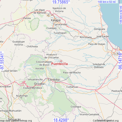
Puentecilla GPS coordinates[2]
19° 5' 44.016" North, 96° 51' 1.008" West
| Map corner | latitude | longitude |
|---|---|---|
| Upper-left | 19.75865°, | -97.55341° |
| Center: | 19.09556°, | -96.85028° |
| Lower-right: | 18.4298°, | -96.14716° |
| Map W x H: | 147.8×147.8 km | = 91.8×91.8mi |
| max Lat: | 32.7° ⇑63.2% North |
| Puentecilla: | 19.09556° |
| min Lat: | ⇓36.8% South 14.53588° |
| min Long | Puentecilla | max Long |
| -117.105° | -96.85028° | -86.73105° |
| W 76.7%⇐ | ⇒23.3% E |
Elevation
Elevation of Puentecilla is 884 m = 2900 ft, and this is 369.7 m = 1213 ft below average elevation for this country.
| Max E: |
3497 m = 11473 ft | 61.9% |
| Avg. | 1253.7 m = 4113 ft | |
| Puentecilla | 884 m = 2900 ft | |
Min E: |
-1 m = -3 ft | 38.1% |
See also: Mexico elevation on elevation.city.
Geographical zone
Puentecilla is located in North Torrid zone (between Equator and Tropic of Cancer). Distance of this Northern Tropic circle is 482.7 km =299.9 mi to North.| Distance of | km | miles | from Puentecilla |
|---|---|---|---|
| North Pole | 7883.8 | 4898.8 | to North |
| Arctic Circle | 5277.9 | 3279.5 | to North |
| Tropic Cancer | 482.7 | 299.9 | to North |
| Equator | 2123.2 | 1319.3 | to South |


Nearby cities:
15 places around Puentecilla: (largest is in red/bold)
• Agua Escondida (El Olvido)
3.3 km =2.1 mi,  111°
111°
• Boca del Monte
6.8 km =4.2 mi,  15°
15°
• Buena Vista
5.9 km =3.7 mi,  186°
186°
• Capulapa
4 km =2.5 mi,  275°
275°
• Chavaxtla
4.4 km =2.7 mi,  28°
28°
• Colonia Manuel González
2.4 km =1.5 mi,  336°
336°
• Comapa
8.5 km =5.3 mi,  333°
333°
• Corazón de Jesús (Piña)
4.3 km =2.7 mi,  139°
139°
• El Triunfo
3.3 km =2.1 mi,  219°
219°
• Ixcatla
7.6 km =4.7 mi,  252°
252°
• La Palma
6.1 km =3.8 mi,  156°
156°
• Ocotitlán
8.5 km =5.3 mi,  225°
225°
• Palo Gacho
8.8 km =5.5 mi,  149°
149°
• Pueblito de Matlaluca
7.5 km =4.7 mi,  117°
117°
• Tepatlaxco
3 km =1.9 mi,  168°
168°
Sources, notices
• [Note1] Compared only with cities in Mexico existing in our database
• [Src1] Map data: © OpenStreetMap contributors (CC-BY-SA)
• [Src2] Other city data from geonames.org with taken over terms of usage.
• [Src3] Geographical zone / Annual Mean Temperature by Robert A. Rohde @ Wikipedia
