Pueblito de Matlaluca geodata
Pueblito de Matlaluca (Veracruz) is a populated place; located in Mexico in America/Mexico_City (GMT-6) time zone. With population of 927 people, there are 9410 cities with bigger population in this country. Compared to other cities in Mexico, 63.6% of cities are located further ↑North; 77.4% of cities are located further ←West and 64.7% of cities have higher elevation than Pueblito de Matlaluca. Note1
Current local time in Pueblito de Matlaluca:
08:30 AM, WednesdayDifference from your time zone: hours


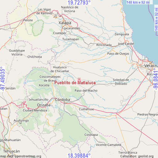
Pueblito de Matlaluca GPS coordinates[2]
19° 3' 52.992" North, 96° 47' 13.992" West
| Map corner | latitude | longitude |
|---|---|---|
| Upper-left | 19.72793°, | -97.49035° |
| Center: | 19.06472°, | -96.78722° |
| Lower-right: | 18.39884°, | -96.0841° |
| Map W x H: | 147.8×147.8 km | = 91.8×91.8mi |
| max Lat: | 32.7° ⇑63.6% North |
| Pueblito de Matlaluca: | 19.06472° |
| min Lat: | ⇓36.4% South 14.53588° |
| min Long | Pueblito de Mat | max Long |
| -117.105° | -96.78722° | -86.73105° |
| W 77.4%⇐ | ⇒22.6% E |
Elevation
Elevation of Pueblito de Matlaluca is 705 m = 2313 ft, and this is 548.7 m = 1800 ft below average elevation for this country.
| Max E: |
3497 m = 11473 ft | 64.7% |
| Avg. | 1253.7 m = 4113 ft | |
| Pueblito de Matlaluca | 705 m = 2313 ft | |
Min E: |
-1 m = -3 ft | 35.3% |
See also: Mexico elevation on elevation.city.
Geographical zone
Pueblito de Matlaluca is located in North Torrid zone (between Equator and Tropic of Cancer). Distance of this Northern Tropic circle is 486.1 km =302 mi to North.| Distance of | km | miles | from Pueblito de Matlaluca |
|---|---|---|---|
| North Pole | 7887.3 | 4900.9 | to North |
| Arctic Circle | 5281.4 | 3281.7 | to North |
| Tropic Cancer | 486.1 | 302 | to North |
| Equator | 2119.8 | 1317.2 | to South |


Nearby cities:
15 places around Pueblito de Matlaluca: (largest is in red/bold)
• Agua Escondida (El Olvido)
4.2 km =2.6 mi,  302°
302°
• Buena Vista
7.7 km =4.8 mi,  251°
251°
• Cerro Azul
6.9 km =4.3 mi,  189°
189°
• Chavaxtla
8.6 km =5.3 mi,  327°
327°
• Colonia Manuel González
9.4 km =5.8 mi,  306°
306°
• Corazón de Jesús (Piña)
3.8 km =2.4 mi,  272°
272°
• Ejido la Piña (Maromilla)
4 km =2.5 mi,  174°
174°
• El Triunfo
8.8 km =5.5 mi,  275°
275°
• La Palma
4.7 km =2.9 mi,  243°
243°
• Mata Naranjo
7.1 km =4.4 mi,  160°
160°
• Palo Gacho
4.7 km =2.9 mi,  207°
207°
• Progreso
8.5 km =5.3 mi, 211°
• Puentecilla
7.5 km =4.7 mi, 297°
• San José Tenejapa
8 km =5 mi,  227°
227°
• Tepatlaxco
6.1 km =3.8 mi, 274°
Sources, notices
• [Note1] Compared only with cities in Mexico existing in our database
• [Src1] Map data: © OpenStreetMap contributors (CC-BY-SA)
• [Src2] Other city data from geonames.org with taken over terms of usage.
• [Src3] Geographical zone / Annual Mean Temperature by Robert A. Rohde @ Wikipedia
