Cháhuac geodata
Cháhuac (Puebla) is a populated place; located in Mexico in America/Mexico_City (GMT-6) time zone. With population of 778 people, there are 11229 cities with bigger population in this country. Compared to other cities in Mexico, 62.7% of cities are located further ↑North; 58.3% of cities are located further ←West and 86.1% of cities have lower elevation than Cháhuac. Note1


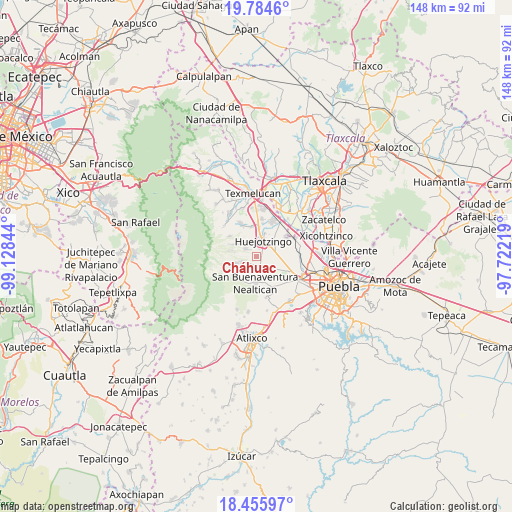
Cháhuac GPS coordinates[2]
19° 7' 17.832" North, 98° 25' 31.116" West
| Map corner | latitude | longitude |
|---|---|---|
| Upper-left | 19.7846°, | -99.12844° |
| Center: | 19.12162°, | -98.42531° |
| Lower-right: | 18.45597°, | -97.72219° |
| Map W x H: | 147.7×147.7 km | = 91.8×91.8mi |
| max Lat: | 32.7° ⇑62.7% North |
| Cháhuac: | 19.12162° |
| min Lat: | ⇓37.3% South 14.53588° |
| min Long | Cháhuac | max Long |
| -117.105° | -98.42531° | -86.73105° |
| W 58.3%⇐ | ⇒41.7% E |
Elevation
Elevation of Cháhuac is 2285 m = 7497 ft, and this is 1031.3 m = 3384 ft above average elevation for this country.
| Max E: |
3497 m = 11473 ft | 13.9% |
| Cháhuac | 2285 m 7497 ft | |
| Avg. | 1253.7 m = 4113 ft | |
Min E: |
-1 m = -3 ft | 86.1% |
See also: Mexico elevation on elevation.city.
Geographical zone
Cháhuac is located in North Torrid zone (between Equator and Tropic of Cancer). Distance of this Northern Tropic circle is 479.8 km =298.1 mi to North.| Distance of | km | miles | from Cháhuac |
|---|---|---|---|
| North Pole | 7880.9 | 4897 | to North |
| Arctic Circle | 5275 | 3277.7 | to North |
| Tropic Cancer | 479.8 | 298.1 | to North |
| Equator | 2126.1 | 1321.1 | to South |


Nearby cities:
15 places around Cháhuac: (largest is in red/bold)
• Domingo Arenas
3.9 km =2.4 mi,  301°
301°
• Huejotzingo
4.5 km =2.8 mi,  23°
23°
• Los Encinos
7 km =4.3 mi, 23°
• Pueblo Nuevo
2.3 km =1.4 mi,  220°
220°
• San Andrés Calpan
4.3 km =2.7 mi,  242°
242°
• San Diego Buenavista
5.8 km =3.6 mi,  280°
280°
• San Juan Pancoac
3.5 km =2.2 mi,  330°
330°
• San Lucas Atzala
6.3 km =3.9 mi,  251°
251°
• San Miguel Papaxtla
7.5 km =4.7 mi,  150°
150°
• San Miguel Tianguizolco
4.4 km =2.7 mi,  338°
338°
• San Pedro Yancuitlalpan
7.8 km =4.8 mi,  231°
231°
• Santa María Atexcac
7.7 km =4.8 mi, 282°
• Santa María Nepopualco
7.6 km =4.7 mi, 295°
• Santa María Tianguistenco
4.4 km =2.7 mi, 333°
• Santa María Zacatepec
6.3 km =3.9 mi,  88°
88°
Sources, notices
• [Note1] Compared only with cities in Mexico existing in our database
• [Src1] Map data: © OpenStreetMap contributors (CC-BY-SA)
• [Src2] Other city data from geonames.org with taken over terms of usage.
• [Src3] Geographical zone / Annual Mean Temperature by Robert A. Rohde @ Wikipedia
