San Pedro Yancuitlalpan geodata
San Pedro Yancuitlalpan (Puebla) is a populated place; located in Mexico in America/Mexico_City (GMT-6) time zone. With population of 2,694 people, there are 3285 cities with bigger population in this country. Compared to other cities in Mexico, 63.4% of cities are located further ↑North; 57.5% of cities are located further ←West and 90.9% of cities have lower elevation than San Pedro Yancuitlalpan. Note1
Current local time in San Pedro Yancuitlalpan:
08:42 AM, MondayDifference from your time zone: hours


San Pedro Yancuitlalpan GPS coordinates[2]
19° 4' 39" North, 98° 28' 59.988" West
| Map corner | latitude | longitude |
|---|---|---|
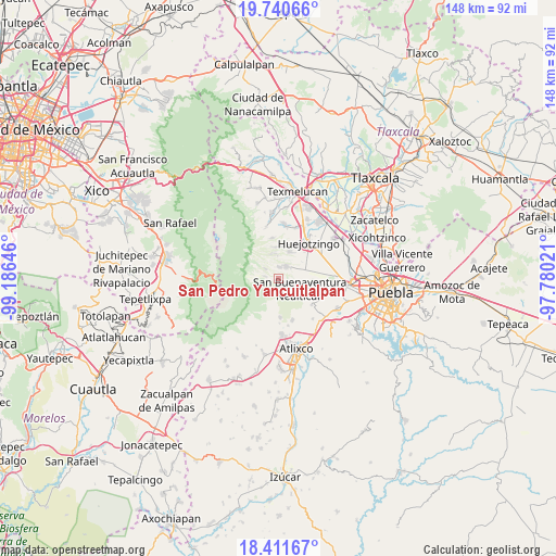
| Upper-left | 19.74066°, | -99.18646° |
| Center: | 19.0775°, | -98.48333° |
| Lower-right: | 18.41167°, | -97.78021° |
| Map W x H: | 147.8×147.8 km | = 91.8×91.8mi |
| max Lat: | 32.7° ⇑63.4% North |
| San Pedro Yancuitlalpan: | 19.0775° |
| min Lat: | ⇓36.6% South 14.53588° |
| min Long | San Pedro Yancu | max Long |
| -117.105° | -98.48333° | -86.73105° |
| W 57.5%⇐ | ⇒42.5% E |
Elevation
Elevation of San Pedro Yancuitlalpan is 2437 m = 7995 ft, and this is 1183.3 m = 3882 ft above average elevation for this country.
| Max E: |
3497 m = 11473 ft | 9.1% |
| San Pedro Yancuitlalpan | 2437 m 7995 ft | |
| Avg. | 1253.7 m = 4113 ft | |
Min E: |
-1 m = -3 ft | 90.9% |
See also: Mexico elevation on elevation.city.
Geographical zone
San Pedro Yancuitlalpan is located in North Torrid zone (between Equator and Tropic of Cancer). Distance of this Northern Tropic circle is 484.7 km =301.2 mi to North.| Distance of | km | miles | from San Pedro Yancuitlalpan |
|---|---|---|---|
| North Pole | 7885.8 | 4900 | to North |
| Arctic Circle | 5280 | 3280.8 | to North |
| Tropic Cancer | 484.7 | 301.2 | to North |
| Equator | 2121.2 | 1318.1 | to South |


Nearby cities:
15 places around San Pedro Yancuitlalpan: (largest is in red/bold)
• Cháhuac
7.8 km =4.8 mi,  51°
51°
• Domingo Arenas
7.5 km =4.7 mi,  21°
21°
• Nealtican
6.6 km =4.1 mi,  117°
117°
• Pueblo Nuevo
5.6 km =3.5 mi,  55°
55°
• San Andrés Calpan
3.7 km =2.3 mi,  37°
37°
• San Diego Buenavista
6 km =3.7 mi,  3°
3°
• San Juan Pancoac
9.1 km =5.7 mi,  28°
28°
• San Lucas Atzala
2.9 km =1.8 mi, 2°
• San Mateo Ozolco
4.2 km =2.6 mi,  306°
306°
• San Miguel Papaxtla
9.9 km =6.2 mi,  99°
99°
• San Nicolás de los Ranchos
0.7 km =0.4 mi,  202°
202°
• Santa María Atexcac
6.7 km =4.2 mi,  347°
347°
• Santa María Nepopualco
8.2 km =5.1 mi, 354°
• Santa María Tianguistenco
9.8 km =6.1 mi, 24°
• Xalitzintla
3.5 km =2.2 mi,  277°
277°
Sources, notices
• [Note1] Compared only with cities in Mexico existing in our database
• [Src1] Map data: © OpenStreetMap contributors (CC-BY-SA)
• [Src2] Other city data from geonames.org with taken over terms of usage.
• [Src3] Geographical zone / Annual Mean Temperature by Robert A. Rohde @ Wikipedia
