San Lucas Atzala geodata
San Lucas Atzala (Puebla) is a populated place; located in Mexico in America/Mexico_City (GMT-6) time zone. With population of 2,483 people, there are 3561 cities with bigger population in this country. Compared to other cities in Mexico, 63% of cities are located further ↑North; 57.5% of cities are located further ←West and 92.1% of cities have lower elevation than San Lucas Atzala. Note1


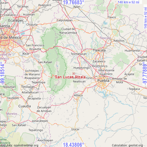
San Lucas Atzala GPS coordinates[2]
19° 6' 13.608" North, 98° 28' 55.236" West
| Map corner | latitude | longitude |
|---|---|---|
| Upper-left | 19.76683°, | -99.18514° |
| Center: | 19.10378°, | -98.48201° |
| Lower-right: | 18.43806°, | -97.77889° |
| Map W x H: | 147.7×147.7 km | = 91.8×91.8mi |
| max Lat: | 32.7° ⇑63% North |
| San Lucas Atzala: | 19.10378° |
| min Lat: | ⇓37% South 14.53588° |
| min Long | San Lucas Atzal | max Long |
| -117.105° | -98.48201° | -86.73105° |
| W 57.5%⇐ | ⇒42.5% E |
Elevation
Elevation of San Lucas Atzala is 2488 m = 8163 ft, and this is 1234.3 m = 4050 ft above average elevation for this country.
| Max E: |
3497 m = 11473 ft | 7.9% |
| San Lucas Atzala | 2488 m 8163 ft | |
| Avg. | 1253.7 m = 4113 ft | |
Min E: |
-1 m = -3 ft | 92.1% |
See also: Mexico elevation on elevation.city.
Geographical zone
San Lucas Atzala is located in North Torrid zone (between Equator and Tropic of Cancer). Distance of this Northern Tropic circle is 481.8 km =299.4 mi to North.| Distance of | km | miles | from San Lucas Atzala |
|---|---|---|---|
| North Pole | 7882.9 | 4898.2 | to North |
| Arctic Circle | 5277 | 3279 | to North |
| Tropic Cancer | 481.8 | 299.4 | to North |
| Equator | 2124.1 | 1319.9 | to South |


Nearby cities:
15 places around San Lucas Atzala: (largest is in red/bold)
• Cháhuac
6.3 km =3.9 mi,  71°
71°
• Domingo Arenas
4.8 km =3 mi,  33°
33°
• Pueblo Nuevo
4.5 km =2.8 mi,  86°
86°
• San Andrés Calpan
2.1 km =1.3 mi, 90°
• San Antonio Tlatenco
8 km =5 mi,  346°
346°
• San Diego Buenavista
3 km =1.9 mi,  3°
3°
• San Juan Pancoac
6.6 km =4.1 mi,  39°
39°
• San Mateo Ozolco
3.6 km =2.2 mi,  263°
263°
• San Miguel Tianguizolco
7.5 km =4.7 mi, 35°
• San Nicolás de los Ranchos
3.6 km =2.2 mi,  186°
186°
• San Pedro Yancuitlalpan
2.9 km =1.8 mi,  182°
182°
• Santa María Atexcac
3.9 km =2.4 mi,  336°
336°
• Santa María Nepopualco
5.3 km =3.3 mi, 349°
• Santa María Tianguistenco
7.1 km =4.4 mi, 33°
• Xalitzintla
4.4 km =2.7 mi,  235°
235°
Sources, notices
• [Note1] Compared only with cities in Mexico existing in our database
• [Src1] Map data: © OpenStreetMap contributors (CC-BY-SA)
• [Src2] Other city data from geonames.org with taken over terms of usage.
• [Src3] Geographical zone / Annual Mean Temperature by Robert A. Rohde @ Wikipedia
