Linda Vista geodata
Linda Vista (Nayarit) is a populated place; located in Mexico in America/Mazatlan (GMT-7) time zone. With population of 769 people, there are 11375 cities with bigger population in this country. Compared to other cities in Mexico, 86.2% of cities are located further ↓South; 91.6% of cities are located further →East and 82.8% of cities have lower elevation than Linda Vista. Note1


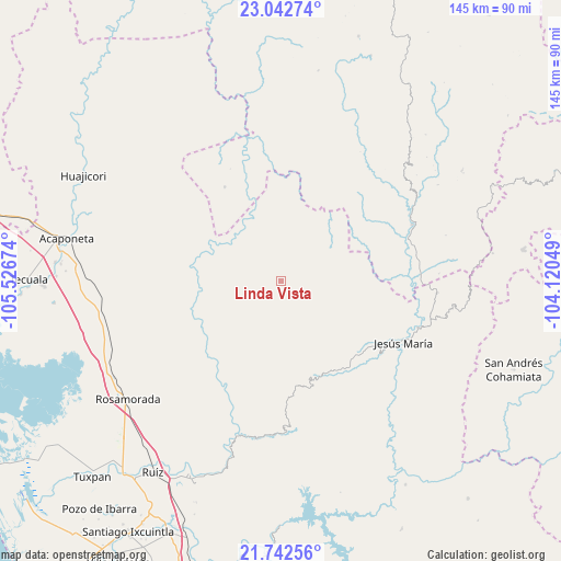
Linda Vista GPS coordinates[2]
22° 23' 39.012" North, 104° 49' 24.996" West
| Map corner | latitude | longitude |
|---|---|---|
| Upper-left | 23.04274°, | -105.52674° |
| Center: | 22.39417°, | -104.82361° |
| Lower-right: | 21.74256°, | -104.12049° |
| Map W x H: | 144.6×144.6 km | = 89.9×89.9mi |
| max Lat: | 32.7° ⇑13.8% North |
| Linda Vista: | 22.39417° |
| min Lat: | ⇓86.2% South 14.53588° |
| min Long | Linda Vista | max Long |
| -117.105° | -104.82361° | -86.73105° |
| W 8.4%⇐ | ⇒91.6% E |
Elevation
Elevation of Linda Vista is 2209 m = 7247 ft, and this is 955.3 m = 3134 ft above average elevation for this country.
| Max E: |
3497 m = 11473 ft | 17.2% |
| Linda Vista | 2209 m 7247 ft | |
| Avg. | 1253.7 m = 4113 ft | |
Min E: |
-1 m = -3 ft | 82.8% |
See also: Mexico elevation on elevation.city.
Geographical zone
Linda Vista is located in North Torrid zone (between Equator and Tropic of Cancer). Distance of this Northern Tropic circle is 115.9 km =72 mi to North.| Distance of | km | miles | from Linda Vista |
|---|---|---|---|
| North Pole | 7517.1 | 4670.9 | to North |
| Arctic Circle | 4911.2 | 3051.7 | to North |
| Tropic Cancer | 115.9 | 72 | to North |
| Equator | 2490 | 1547.2 | to South |


Nearby cities:
15 places around Linda Vista: (largest is in red/bold)
• Bancos de Calitique
44.4 km =27.6 mi,  82°
82°
• Cofradía de Cuyutlán
48.3 km =30 mi,  218°
218°
• Huazamota
36.6 km =22.7 mi,  66°
66°
• Jesús María
35.3 km =21.9 mi,  116°
116°
• Mesa del Nayar
26.3 km =16.3 mi,  138°
138°
• Mojocuautla (Adjuntas)
41.1 km =25.5 mi,  212°
212°
• Paramita
47.4 km =29.5 mi,  233°
233°
• Presidio de los Reyes
41 km =25.5 mi,  195°
195°
• San Francisco
35.4 km =22 mi,  109°
109°
• San Juan Bautista
39.6 km =24.6 mi, 225°
• San Miguel
47.9 km =29.8 mi,  261°
261°
• San Pedro Ixcatan
41 km =25.5 mi, 196°
• Santa Fe
47.5 km =29.5 mi, 212°
• Santa Teresa
12.9 km =8 mi,  27°
27°
• Teponahuaxtla
42.2 km =26.2 mi,  243°
243°
Sources, notices
• [Note1] Compared only with cities in Mexico existing in our database
• [Src1] Map data: © OpenStreetMap contributors (CC-BY-SA)
• [Src2] Other city data from geonames.org with taken over terms of usage.
• [Src3] Geographical zone / Annual Mean Temperature by Robert A. Rohde @ Wikipedia
