Jesús María geodata
Jesús María (Nayarit) is a seat of a second-order administrative division; located in Mexico in America/Mazatlan (GMT-7) time zone. With population of 2,638 people, there are 3347 cities with bigger population in this country. Compared to other cities in Mexico, 85.5% of cities are located further ↓South; 91% of cities are located further →East and 69.8% of cities have higher elevation than Jesús María. Note1


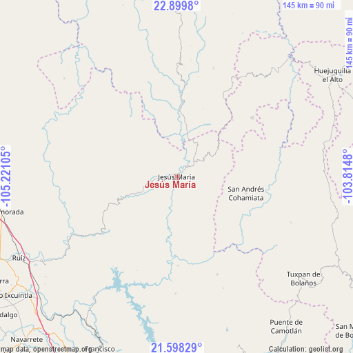
Jesús María GPS coordinates[2]
22° 15' 2.016" North, 104° 31' 4.512" West
| Map corner | latitude | longitude |
|---|---|---|
| Upper-left | 22.8998°, | -105.22105° |
| Center: | 22.25056°, | -104.51792° |
| Lower-right: | 21.59829°, | -103.8148° |
| Map W x H: | 144.7×144.7 km | = 89.9×89.9mi |
| max Lat: | 32.7° ⇑14.5% North |
| Jesús María: | 22.25056° |
| min Lat: | ⇓85.5% South 14.53588° |
| min Long | Jesús María | max Long |
| -117.105° | -104.51792° | -86.73105° |
| W 9%⇐ | ⇒91% E |
Elevation
Elevation of Jesús María is 426 m = 1398 ft, and this is 827.7 m = 2716 ft below average elevation for this country.
| Max E: |
3497 m = 11473 ft | 69.8% |
| Avg. | 1253.7 m = 4113 ft | |
| Jesús María | 426 m = 1398 ft | |
Min E: |
-1 m = -3 ft | 30.2% |
See also: Mexico elevation on elevation.city.
Geographical zone
Jesús María is located in North Torrid zone (between Equator and Tropic of Cancer). Distance of this Northern Tropic circle is 131.9 km =82 mi to North.| Distance of | km | miles | from Jesús María |
|---|---|---|---|
| North Pole | 7533 | 4680.8 | to North |
| Arctic Circle | 4927.1 | 3061.6 | to North |
| Tropic Cancer | 131.9 | 82 | to North |
| Equator | 2474 | 1537.3 | to South |


Nearby cities:
15 places around Jesús María: (largest is in red/bold)
• Bancos de Calitique
25.1 km =15.6 mi,  30°
30°
• El Venado
60.3 km =37.5 mi,  235°
235°
• Huaynamota
36.5 km =22.7 mi,  179°
179°
• Huazamota
30.6 km =19 mi,  4°
4°
• Las Higueras
47.9 km =29.8 mi, 180°
• Linda Vista
35.3 km =21.9 mi,  296°
296°
• Mesa del Nayar
14.4 km =8.9 mi,  255°
255°
• Mojocuautla (Adjuntas)
56.9 km =35.4 mi,  250°
250°
• Presidio de los Reyes
48.3 km =30 mi, 240°
• San Andrés Cohamiata
29.3 km =18.2 mi,  103°
103°
• San Francisco
4.6 km =2.9 mi,  24°
24°
• San Miguel (San Miguel Huaixtita)
28.5 km =17.7 mi,  134°
134°
• San Pedro Ixcatan
48.8 km =30.3 mi, 241°
• Santa Lucía de la Sierra
39.4 km =24.5 mi,  51°
51°
• Santa Teresa
37.4 km =23.2 mi,  317°
317°
Sources, notices
• [Note1] Compared only with cities in Mexico existing in our database
• [Src1] Map data: © OpenStreetMap contributors (CC-BY-SA)
• [Src2] Other city data from geonames.org with taken over terms of usage.
• [Src3] Geographical zone / Annual Mean Temperature by Robert A. Rohde @ Wikipedia
