Miguel Hidalgo geodata
Miguel Hidalgo (Chiapas) is a populated place; located in Mexico in America/Mexico_City (GMT-6) time zone. With population of 767 people, there are 11411 cities with bigger population in this country. Compared to other cities in Mexico, 98.5% of cities are located further ↑North; 94.8% of cities are located further ←West and 51.4% of cities have lower elevation than Miguel Hidalgo. Note1


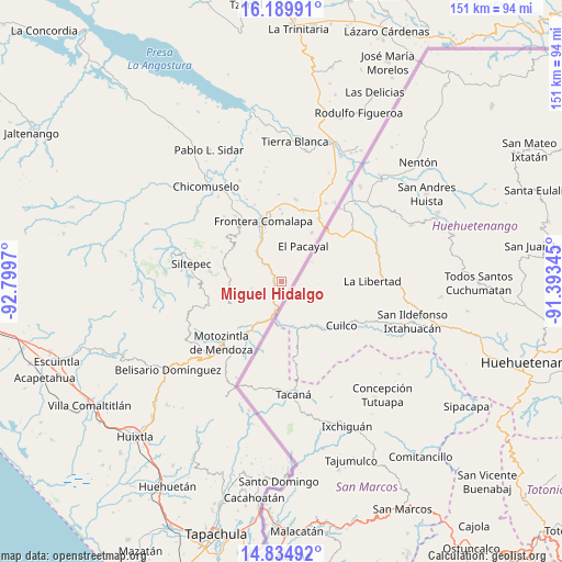
Miguel Hidalgo GPS coordinates[2]
15° 30' 48.708" North, 92° 5' 47.652" West
| Map corner | latitude | longitude |
|---|---|---|
| Upper-left | 16.18991°, | -92.7997° |
| Center: | 15.51353°, | -92.09657° |
| Lower-right: | 14.83492°, | -91.39345° |
| Map W x H: | 150.7×150.7 km | = 93.6×93.6mi |
| max Lat: | 32.7° ⇑98.5% North |
| Miguel Hidalgo: | 15.51353° |
| min Lat: | ⇓1.5% South 14.53588° |
| min Long | Miguel Hidalgo | max Long |
| -117.105° | -92.09657° | -86.73105° |
| W 94.8%⇐ | ⇒5.2% E |
Elevation
Elevation of Miguel Hidalgo is 1503 m = 4931 ft, and this is 249.3 m = 818 ft above average elevation for this country.
| Max E: |
3497 m = 11473 ft | 48.6% |
| Miguel Hidalgo | 1503 m 4931 ft | |
| Avg. | 1253.7 m = 4113 ft | |
Min E: |
-1 m = -3 ft | 51.4% |
See also: Mexico elevation on elevation.city.
Geographical zone
Miguel Hidalgo is located in North Torrid zone (between Equator and Tropic of Cancer). Distance of this Northern Tropic circle is 881 km =547.4 mi to North.| Distance of | km | miles | from Miguel Hidalgo |
|---|---|---|---|
| North Pole | 8282.1 | 5146.3 | to North |
| Arctic Circle | 5676.2 | 3527 | to North |
| Tropic Cancer | 881 | 547.4 | to North |
| Equator | 1724.9 | 1071.8 | to South |


Nearby cities:
15 places around Miguel Hidalgo: (largest is in red/bold)
• Amatenango de la Frontera
9 km =5.6 mi,  193°
193°
• Bejucal de Ocampo
9.3 km =5.8 mi,  225°
225°
• El Pacayal
11.1 km =6.9 mi,  31°
31°
• El Pino
9.8 km =6.1 mi, 228°
• Francisco I. Madero
1 km =0.6 mi,  80°
80°
• Guadalupe Victoria
11 km =6.8 mi,  19°
19°
• La Montaña
11.8 km =7.3 mi,  303°
303°
• Monte Ordóñez
9.7 km =6 mi, 304°
• Nuevo Amatenango
1.5 km =0.9 mi,  248°
248°
• Ojo de Agua Centro
8.4 km =5.2 mi,  257°
257°
• Ojo de Agua Grande
7.5 km =4.7 mi, 249°
• Pacayalito
9.2 km =5.7 mi,  2°
2°
• Reforma
3.5 km =2.2 mi,  308°
308°
• Río Guerrero
10.2 km =6.3 mi,  320°
320°
• Veinte de Noviembre
5.8 km =3.6 mi, 19°
Sources, notices
• [Note1] Compared only with cities in Mexico existing in our database
• [Src1] Map data: © OpenStreetMap contributors (CC-BY-SA)
• [Src2] Other city data from geonames.org with taken over terms of usage.
• [Src3] Geographical zone / Annual Mean Temperature by Robert A. Rohde @ Wikipedia
