Nuevo Chicayán geodata
Nuevo Chicayán (Veracruz) is a populated place; located in Mexico in America/Mexico_City (GMT-6) time zone. With population of 765 people, there are 11448 cities with bigger population in this country. Compared to other cities in Mexico, 82.8% of cities are located further ↓South; 61.6% of cities are located further ←West and 88.6% of cities have higher elevation than Nuevo Chicayán. Note1


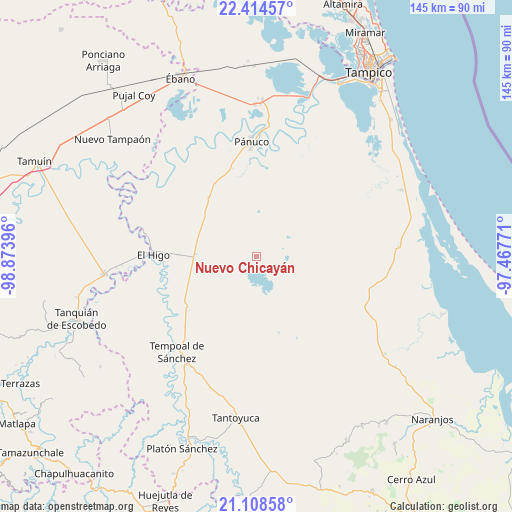
Nuevo Chicayán GPS coordinates[2]
21° 45' 47.016" North, 98° 10' 14.988" West
| Map corner | latitude | longitude |
|---|---|---|
| Upper-left | 22.41457°, | -98.87396° |
| Center: | 21.76306°, | -98.17083° |
| Lower-right: | 21.10858°, | -97.46771° |
| Map W x H: | 145.2×145.2 km | = 90.2×90.2mi |
| max Lat: | 32.7° ⇑17.2% North |
| Nuevo Chicayán: | 21.76306° |
| min Lat: | ⇓82.8% South 14.53588° |
| min Long | Nuevo Chicayán | max Long |
| -117.105° | -98.17083° | -86.73105° |
| W 61.6%⇐ | ⇒38.4% E |
Elevation
Elevation of Nuevo Chicayán is 28 m = 92 ft, and this is 1225.7 m = 4021 ft below average elevation for this country.
| Max E: |
3497 m = 11473 ft | 88.6% |
| Avg. | 1253.7 m = 4113 ft | |
| Nuevo Chicayán | 28 m = 92 ft | |
Min E: |
-1 m = -3 ft | 11.4% |
See also: Mexico elevation on elevation.city.
Geographical zone
Nuevo Chicayán is located in North Torrid zone (between Equator and Tropic of Cancer). Distance of this Northern Tropic circle is 186.1 km =115.6 mi to North.| Distance of | km | miles | from Nuevo Chicayán |
|---|---|---|---|
| North Pole | 7587.2 | 4714.5 | to North |
| Arctic Circle | 4981.3 | 3095.2 | to North |
| Tropic Cancer | 186.1 | 115.6 | to North |
| Equator | 2419.8 | 1503.6 | to South |


Nearby cities:
15 places around Nuevo Chicayán: (largest is in red/bold)
• Aquiles Serdán
12.3 km =7.6 mi,  11°
11°
• Bellavista
31.9 km =19.8 mi,  256°
256°
• Cruz de Palma
28.9 km =18 mi,  203°
203°
• Cuve de Badeas
24.7 km =15.3 mi, 261°
• Ejido Rancho Alegre
19.4 km =12.1 mi, 255°
• El Chote
31.2 km =19.4 mi,  280°
280°
• El Higo
29 km =18 mi,  270°
270°
• El Molino
21.5 km =13.4 mi,  322°
322°
• El Pueblito
29.8 km =18.5 mi, 277°
• Las Badeas
25.1 km =15.6 mi, 264°
• Magozal
29.2 km =18.1 mi,  137°
137°
• Paso Real
8.1 km =5 mi,  57°
57°
• Poblado Tierra y Libertad (Paso Piedra)
15.3 km =9.5 mi,  47°
47°
• Potrero Horcón
21.3 km =13.2 mi,  214°
214°
• Pánuco (La Pitahaya) [Nuevo Centro de Población]
20.7 km =12.9 mi, 9°
Sources, notices
• [Note1] Compared only with cities in Mexico existing in our database
• [Src1] Map data: © OpenStreetMap contributors (CC-BY-SA)
• [Src2] Other city data from geonames.org with taken over terms of usage.
• [Src3] Geographical zone / Annual Mean Temperature by Robert A. Rohde @ Wikipedia
