El Farallón geodata
El Farallón (Veracruz) is a populated place; located in Mexico in America/Mexico_City (GMT-6) time zone. With population of 763 people, there are 11483 cities with bigger population in this country. Compared to other cities in Mexico, 51.2% of cities are located further ↑North; 80.2% of cities are located further ←West and 88% of cities have higher elevation than El Farallón. Note1


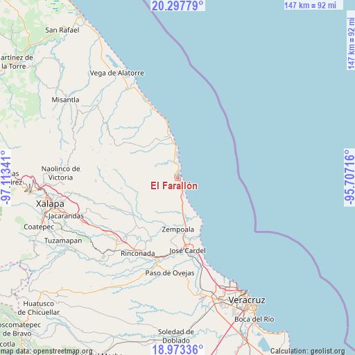
El Farallón GPS coordinates[2]
19° 38' 12.984" North, 96° 24' 37.008" West
| Map corner | latitude | longitude |
|---|---|---|
| Upper-left | 20.29779°, | -97.11341° |
| Center: | 19.63694°, | -96.41028° |
| Lower-right: | 18.97336°, | -95.70716° |
| Map W x H: | 147.3×147.3 km | = 91.5×91.5mi |
| max Lat: | 32.7° ⇑51.2% North |
| El Farallón: | 19.63694° |
| min Lat: | ⇓48.8% South 14.53588° |
| min Long | El Farallón | max Long |
| -117.105° | -96.41028° | -86.73105° |
| W 80.2%⇐ | ⇒19.8% E |
Elevation
Elevation of El Farallón is 30 m = 98 ft, and this is 1223.7 m = 4015 ft below average elevation for this country.
| Max E: |
3497 m = 11473 ft | 88% |
| Avg. | 1253.7 m = 4113 ft | |
| El Farallón | 30 m = 98 ft | |
Min E: |
-1 m = -3 ft | 12% |
See also: Mexico elevation on elevation.city.
Geographical zone
El Farallón is located in North Torrid zone (between Equator and Tropic of Cancer). Distance of this Northern Tropic circle is 422.5 km =262.5 mi to North.| Distance of | km | miles | from El Farallón |
|---|---|---|---|
| North Pole | 7823.6 | 4861.4 | to North |
| Arctic Circle | 5217.8 | 3242.2 | to North |
| Tropic Cancer | 422.5 | 262.5 | to North |
| Equator | 2183.4 | 1356.7 | to South |


Nearby cities:
15 places around El Farallón: (largest is in red/bold)
• El Chalahuite
18.7 km =11.6 mi,  168°
168°
• El Viejón Nuevo
5.7 km =3.5 mi,  359°
359°
• El Zapotito
21.2 km =13.2 mi,  187°
187°
• Hornitos
19.6 km =12.2 mi,  183°
183°
• Mozomboa
16.3 km =10.1 mi,  205°
205°
• Palma Sola
15.1 km =9.4 mi,  351°
351°
• Palmas de Abajo
5.9 km =3.7 mi, 207°
• Paso de Doña Juana
18.6 km =11.6 mi,  162°
162°
• Paso del Cedro
14.9 km =9.3 mi, 171°
• San Isidro
17.5 km =10.9 mi, 169°
• San José Pastorías
18.6 km =11.6 mi,  244°
244°
• Santa Rosa
19.3 km =12 mi,  197°
197°
• Tinajitas
4 km =2.5 mi, 238°
• Villa Zempoala
21.4 km =13.3 mi, 179°
• Zoyacuautla
18.7 km =11.6 mi,  249°
249°
Sources, notices
• [Note1] Compared only with cities in Mexico existing in our database
• [Src1] Map data: © OpenStreetMap contributors (CC-BY-SA)
• [Src2] Other city data from geonames.org with taken over terms of usage.
• [Src3] Geographical zone / Annual Mean Temperature by Robert A. Rohde @ Wikipedia
