El Viejón Nuevo geodata
El Viejón Nuevo (Veracruz) is a populated place; located in Mexico in America/Mexico_City (GMT-6) time zone. With population of 610 people, there are 14138 cities with bigger population in this country. Compared to other cities in Mexico, 50.1% of cities are located further ↓South; 80.2% of cities are located further ←West and 95.7% of cities have higher elevation than El Viejón Nuevo. Note1


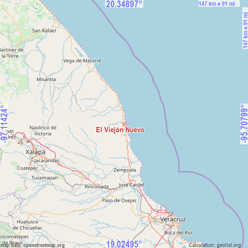
El Viejón Nuevo GPS coordinates[2]
19° 41' 17.988" North, 96° 24' 39.996" West
| Map corner | latitude | longitude |
|---|---|---|
| Upper-left | 20.34897°, | -97.11424° |
| Center: | 19.68833°, | -96.41111° |
| Lower-right: | 19.02495°, | -95.70799° |
| Map W x H: | 147.2×147.2 km | = 91.5×91.5mi |
| max Lat: | 32.7° ⇑49.9% North |
| El Viejón Nuevo: | 19.68833° |
| min Lat: | ⇓50.1% South 14.53588° |
| min Long | El Viejón Nuev | max Long |
| -117.105° | -96.41111° | -86.73105° |
| W 80.2%⇐ | ⇒19.8% E |
Elevation
Elevation of El Viejón Nuevo is 12 m = 39 ft, and this is 1241.7 m = 4074 ft below average elevation for this country.
| Max E: |
3497 m = 11473 ft | 95.7% |
| Avg. | 1253.7 m = 4113 ft | |
| El Viejón Nuevo | 12 m = 39 ft | |
Min E: |
-1 m = -3 ft | 4.3% |
See also: Mexico elevation on elevation.city.
Geographical zone
El Viejón Nuevo is located in North Torrid zone (between Equator and Tropic of Cancer). Distance of this Northern Tropic circle is 416.8 km =259 mi to North.| Distance of | km | miles | from El Viejón Nuevo |
|---|---|---|---|
| North Pole | 7817.9 | 4857.8 | to North |
| Arctic Circle | 5212 | 3238.6 | to North |
| Tropic Cancer | 416.8 | 259 | to North |
| Equator | 2189.1 | 1360.2 | to South |


Nearby cities:
15 places around El Viejón Nuevo: (largest is in red/bold)
• El Chalahuite
24.3 km =15.1 mi,  170°
170°
• El Farallón
5.7 km =3.5 mi,  179°
179°
• Hornitos
25.3 km =15.7 mi, 182°
• La Reforma
25.4 km =15.8 mi,  246°
246°
• Mozomboa
21.6 km =13.4 mi,  198°
198°
• Palma Sola
9.5 km =5.9 mi,  346°
346°
• Palmas de Abajo
11.3 km =7 mi,  193°
193°
• Paso de Doña Juana
24.2 km =15 mi, 166°
• Paso del Cedro
20.6 km =12.8 mi, 173°
• San Isidro
23.1 km =14.4 mi, 171°
• San José Pastorías
21.7 km =13.5 mi,  230°
230°
• Santa Ana
24.6 km =15.3 mi,  335°
335°
• Santa Rosa
24.8 km =15.4 mi, 193°
• Tinajitas
8.5 km =5.3 mi, 202°
• Zoyacuautla
21.4 km =13.3 mi, 234°
Sources, notices
• [Note1] Compared only with cities in Mexico existing in our database
• [Src1] Map data: © OpenStreetMap contributors (CC-BY-SA)
• [Src2] Other city data from geonames.org with taken over terms of usage.
• [Src3] Geographical zone / Annual Mean Temperature by Robert A. Rohde @ Wikipedia
