Tatzecuala geodata
Tatzecuala (Puebla) is a populated place; located in Mexico in America/Mexico_City (GMT-6) time zone. With population of 762 people, there are 11496 cities with bigger population in this country. Compared to other cities in Mexico, 54.4% of cities are located further ↓South; 69.1% of cities are located further ←West and 77.5% of cities have lower elevation than Tatzecuala. Note1


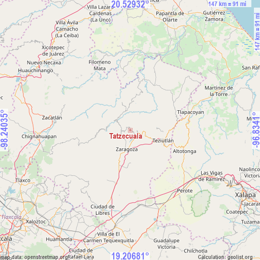
Tatzecuala GPS coordinates[2]
19° 52' 9.984" North, 97° 32' 13.992" West
| Map corner | latitude | longitude |
|---|---|---|
| Upper-left | 20.52932°, | -98.24035° |
| Center: | 19.86944°, | -97.53722° |
| Lower-right: | 19.20681°, | -96.8341° |
| Map W x H: | 147×147.1 km | = 91.3×91.4mi |
| max Lat: | 32.7° ⇑45.6% North |
| Tatzecuala: | 19.86944° |
| min Lat: | ⇓54.4% South 14.53588° |
| min Long | Tatzecuala | max Long |
| -117.105° | -97.53722° | -86.73105° |
| W 69.1%⇐ | ⇒30.9% E |
Elevation
Elevation of Tatzecuala is 2078 m = 6818 ft, and this is 824.3 m = 2704 ft above average elevation for this country.
| Max E: |
3497 m = 11473 ft | 22.5% |
| Tatzecuala | 2078 m 6818 ft | |
| Avg. | 1253.7 m = 4113 ft | |
Min E: |
-1 m = -3 ft | 77.5% |
See also: Mexico elevation on elevation.city.
Geographical zone
Tatzecuala is located in North Torrid zone (between Equator and Tropic of Cancer). Distance of this Northern Tropic circle is 396.6 km =246.4 mi to North.| Distance of | km | miles | from Tatzecuala |
|---|---|---|---|
| North Pole | 7797.8 | 4845.3 | to North |
| Arctic Circle | 5191.9 | 3226.1 | to North |
| Tropic Cancer | 396.6 | 246.4 | to North |
| Equator | 2209.3 | 1372.8 | to South |


Nearby cities:
15 places around Tatzecuala: (largest is in red/bold)
• Ahuacatlán
1.7 km =1.1 mi,  331°
331°
• Atalpa
3.9 km =2.4 mi,  116°
116°
• Atalpan
3.7 km =2.3 mi,  219°
219°
• Ciudad de Tlatlauquitepec
4.8 km =3 mi,  112°
112°
• Cohuatzalpan
4.4 km =2.7 mi,  309°
309°
• Cuacuilco
2.1 km =1.3 mi,  198°
198°
• El Mirador
5.4 km =3.4 mi,  156°
156°
• El Progreso
3.1 km =1.9 mi,  348°
348°
• Huaxtla
4.4 km =2.7 mi,  126°
126°
• Nexticapan
5 km =3.1 mi, 200°
• Santa Cruz Xaltetela
4.6 km =2.9 mi,  276°
276°
• Tatauzoquico
4.7 km =2.9 mi,  166°
166°
• Tatoxcac
3.7 km =2.3 mi,  270°
270°
• Tlatlauquitepec
4.8 km =3 mi, 120°
• Zacapoaxtla
5.4 km =3.4 mi, 273°
Sources, notices
• [Note1] Compared only with cities in Mexico existing in our database
• [Src1] Map data: © OpenStreetMap contributors (CC-BY-SA)
• [Src2] Other city data from geonames.org with taken over terms of usage.
• [Src3] Geographical zone / Annual Mean Temperature by Robert A. Rohde @ Wikipedia
