Cohuatzalpan geodata
Cohuatzalpan (Puebla) is a populated place; located in Mexico in America/Mexico_City (GMT-6) time zone. With population of 589 people, there are 14579 cities with bigger population in this country. Compared to other cities in Mexico, 54.9% of cities are located further ↓South; 68.8% of cities are located further ←West and 67.2% of cities have lower elevation than Cohuatzalpan. Note1


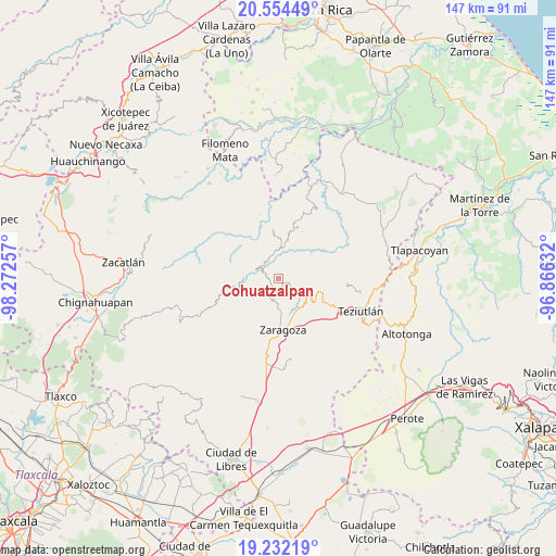
Cohuatzalpan GPS coordinates[2]
19° 53' 40.992" North, 97° 34' 9.984" West
| Map corner | latitude | longitude |
|---|---|---|
| Upper-left | 20.55449°, | -98.27257° |
| Center: | 19.89472°, | -97.56944° |
| Lower-right: | 19.23219°, | -96.86632° |
| Map W x H: | 147×147 km | = 91.3×91.3mi |
| max Lat: | 32.7° ⇑45.1% North |
| Cohuatzalpan: | 19.89472° |
| min Lat: | ⇓54.9% South 14.53588° |
| min Long | Cohuatzalpan | max Long |
| -117.105° | -97.56944° | -86.73105° |
| W 68.8%⇐ | ⇒31.2% E |
Elevation
Elevation of Cohuatzalpan is 1872 m = 6142 ft, and this is 618.3 m = 2029 ft above average elevation for this country.
| Max E: |
3497 m = 11473 ft | 32.8% |
| Cohuatzalpan | 1872 m 6142 ft | |
| Avg. | 1253.7 m = 4113 ft | |
Min E: |
-1 m = -3 ft | 67.2% |
See also: Mexico elevation on elevation.city.
Geographical zone
Cohuatzalpan is located in North Torrid zone (between Equator and Tropic of Cancer). Distance of this Northern Tropic circle is 393.8 km =244.7 mi to North.| Distance of | km | miles | from Cohuatzalpan |
|---|---|---|---|
| North Pole | 7795 | 4843.6 | to North |
| Arctic Circle | 5189.1 | 3224.4 | to North |
| Tropic Cancer | 393.8 | 244.7 | to North |
| Equator | 2212.1 | 1374.5 | to South |


Nearby cities:
15 places around Cohuatzalpan: (largest is in red/bold)
• Ahuacatlán
2.9 km =1.8 mi,  117°
117°
• Atalpan
5.8 km =3.6 mi,  170°
170°
• Comaltepec
5.1 km =3.2 mi,  218°
218°
• Cuacuilco
5.6 km =3.5 mi,  150°
150°
• El Progreso
2.7 km =1.7 mi,  84°
84°
• Los Cristales (Talican)
3.6 km =2.2 mi,  226°
226°
• San Francisco Zacapexpan
3.2 km =2 mi,  240°
240°
• San Juan Tahitic
5 km =3.1 mi,  22°
22°
• Santa Cruz Xaltetela
2.6 km =1.6 mi,  207°
207°
• Tatoxcac
2.8 km =1.7 mi,  187°
187°
• Tatzecuala
4.4 km =2.7 mi,  129°
129°
• Xalacapan de Lucke
2.4 km =1.5 mi,  295°
295°
• Xilita
3.3 km =2.1 mi,  330°
330°
• Xochitepec
3.1 km =1.9 mi, 19°
• Zacapoaxtla
3.2 km =2 mi, 219°
Sources, notices
• [Note1] Compared only with cities in Mexico existing in our database
• [Src1] Map data: © OpenStreetMap contributors (CC-BY-SA)
• [Src2] Other city data from geonames.org with taken over terms of usage.
• [Src3] Geographical zone / Annual Mean Temperature by Robert A. Rohde @ Wikipedia
