Lagunilla geodata
Lagunilla (Veracruz) is a populated place; located in Mexico in America/Mexico_City (GMT-6) time zone. With population of 588 people, there are 14598 cities with bigger population in this country. Compared to other cities in Mexico, 66.8% of cities are located further ↑North; 74.1% of cities are located further ←West and 54.9% of cities have higher elevation than Lagunilla. Note1


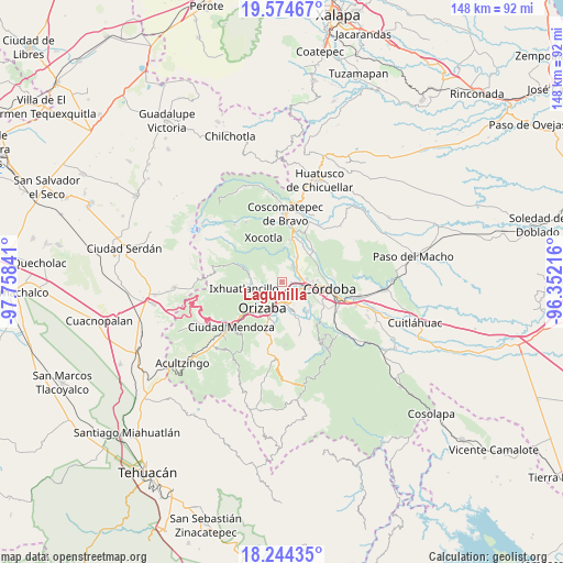
Lagunilla GPS coordinates[2]
18° 54' 38.988" North, 97° 3' 19.008" West
| Map corner | latitude | longitude |
|---|---|---|
| Upper-left | 19.57467°, | -97.75841° |
| Center: | 18.91083°, | -97.05528° |
| Lower-right: | 18.24435°, | -96.35216° |
| Map W x H: | 147.9×147.9 km | = 91.9×91.9mi |
| max Lat: | 32.7° ⇑66.8% North |
| Lagunilla: | 18.91083° |
| min Lat: | ⇓33.2% South 14.53588° |
| min Long | Lagunilla | max Long |
| -117.105° | -97.05528° | -86.73105° |
| W 74.1%⇐ | ⇒25.9% E |
Elevation
Elevation of Lagunilla is 1200 m = 3937 ft, and this is 53.7 m = 176 ft below average elevation for this country.
| Max E: |
3497 m = 11473 ft | 54.9% |
| Avg. | 1253.7 m = 4113 ft | |
| Lagunilla | 1200 m = 3937 ft | |
Min E: |
-1 m = -3 ft | 45.1% |
See also: Mexico elevation on elevation.city.
Geographical zone
Lagunilla is located in North Torrid zone (between Equator and Tropic of Cancer). Distance of this Northern Tropic circle is 503.2 km =312.7 mi to North.| Distance of | km | miles | from Lagunilla |
|---|---|---|---|
| North Pole | 7904.4 | 4911.6 | to North |
| Arctic Circle | 5298.5 | 3292.3 | to North |
| Tropic Cancer | 503.2 | 312.7 | to North |
| Equator | 2102.7 | 1306.6 | to South |


Nearby cities:
15 places around Lagunilla: (largest is in red/bold)
• Atzacan
3 km =1.9 mi,  262°
262°
• Buenavista
2.8 km =1.7 mi,  135°
135°
• Chicola
5.7 km =3.5 mi, 259°
• Coapichapan (Barranca de San Miguel)
6.2 km =3.9 mi,  115°
115°
• Cuautlapán
5 km =3.1 mi, 137°
• Cumbre de Metlac
3.5 km =2.2 mi,  61°
61°
• Dos Ríos
4.8 km =3 mi,  36°
36°
• Fortín de las Flores
5.8 km =3.6 mi,  93°
93°
• La Sidra
3.6 km =2.2 mi,  314°
314°
• Monte Salas
4.9 km =3 mi,  52°
52°
• Moyoapan
1.2 km =0.7 mi, 56°
• Revolución
4.6 km =2.9 mi,  235°
235°
• Rincón Grande
5.9 km =3.7 mi, 310°
• Sumidero
3.6 km =2.2 mi,  102°
102°
• Tocuila
6 km =3.7 mi, 42°
Sources, notices
• [Note1] Compared only with cities in Mexico existing in our database
• [Src1] Map data: © OpenStreetMap contributors (CC-BY-SA)
• [Src2] Other city data from geonames.org with taken over terms of usage.
• [Src3] Geographical zone / Annual Mean Temperature by Robert A. Rohde @ Wikipedia
