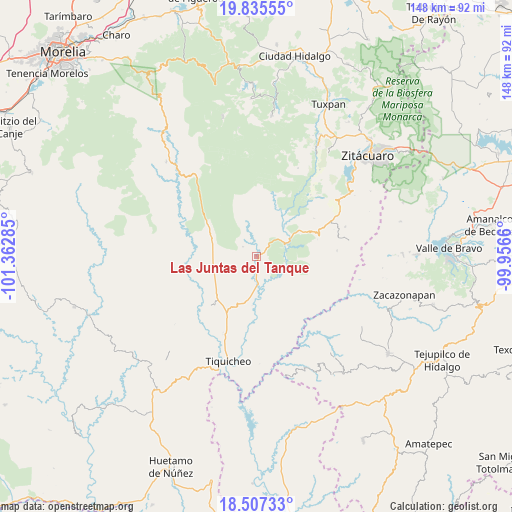
Las Juntas del Tanque geodata
Las Juntas del Tanque (Michoacán) is a populated place; located in Mexico in America/Mexico_City (GMT-6) time zone. With population of 508 people, there are 16554 cities with bigger population in this country. Compared to other cities in Mexico, 61.7% of cities are located further ↑North; 70.8% of cities are located further →East and 67.8% of cities have higher elevation than Las Juntas del Tanque. Note1
Current local time in Las Juntas del Tanque:
08:33 AM, WednesdayDifference from your time zone: hours


Las Juntas del Tanque GPS coordinates[2]
19° 10' 22.008" North, 100° 39' 34.992" West
| Map corner | latitude | longitude |
|---|---|---|
| Upper-left | 19.83555°, | -101.36285° |
| Center: | 19.17278°, | -100.65972° |
| Lower-right: | 18.50733°, | -99.9566° |
| Map W x H: | 147.7×147.7 km | = 91.8×91.8mi |
| max Lat: | 32.7° ⇑61.7% North |
| Las Juntas del Tanque: | 19.17278° |
| min Lat: | ⇓38.3% South 14.53588° |
| min Long | Las Juntas del | max Long |
| -117.105° | -100.65972° | -86.73105° |
| W 29.2%⇐ | ⇒70.8% E |
Elevation
Elevation of Las Juntas del Tanque is 538 m = 1765 ft, and this is 715.7 m = 2348 ft below average elevation for this country.
| Max E: |
3497 m = 11473 ft | 67.8% |
| Avg. | 1253.7 m = 4113 ft | |
| Las Juntas del Tanque | 538 m = 1765 ft | |
Min E: |
-1 m = -3 ft | 32.2% |
See also: Mexico elevation on elevation.city.
Geographical zone
Las Juntas del Tanque is located in North Torrid zone (between Equator and Tropic of Cancer). Distance of this Northern Tropic circle is 474.1 km =294.6 mi to North.| Distance of | km | miles | from Las Juntas del Tanque |
|---|---|---|---|
| North Pole | 7875.2 | 4893.4 | to North |
| Arctic Circle | 5269.4 | 3274.3 | to North |
| Tropic Cancer | 474.1 | 294.6 | to North |
| Equator | 2131.8 | 1324.6 | to South |


Nearby cities:
15 places around Las Juntas del Tanque: (largest is in red/bold)
• Arroyo Seco
8.6 km =5.3 mi,  67°
67°
• Benito Juárez
21.4 km =13.3 mi, 71°
• Ceibas de Trujillo
23 km =14.3 mi,  173°
173°
• Cerro Colorado de Ocampo
26 km =16.2 mi,  51°
51°
• El Llano
25.5 km =15.8 mi,  264°
264°
• El Olivo
18 km =11.2 mi,  16°
16°
• El Rodeo
24.8 km =15.4 mi, 53°
• La Florida
26.3 km =16.3 mi,  38°
38°
• Manzana de la Mora
23.5 km =14.6 mi, 41°
• Parícuaro
23.3 km =14.5 mi,  64°
64°
• Purungueo
23.8 km =14.8 mi,  225°
225°
• Rancho Viejo
26.8 km =16.7 mi, 71°
• Santa Ana de Guerrero (El Cascabel)
25.7 km =16 mi, 63°
• Tremesino
23.2 km =14.4 mi,  85°
85°
• Tuzantla
10.3 km =6.4 mi, 71°
Sources, notices
• [Note1] Compared only with cities in Mexico existing in our database
• [Src1] Map data: © OpenStreetMap contributors (CC-BY-SA)
• [Src2] Other city data from geonames.org with taken over terms of usage.
• [Src3] Geographical zone / Annual Mean Temperature by Robert A. Rohde @ Wikipedia
