Las Pimientas geodata
Las Pimientas (Chiapas) is a populated place; located in Mexico in America/Mexico_City (GMT-6) time zone. With population of 707 people, there are 12307 cities with bigger population in this country. Compared to other cities in Mexico, 89.6% of cities are located further ↑North; 86.6% of cities are located further ←West and 66.9% of cities have higher elevation than Las Pimientas. Note1


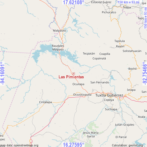
Las Pimientas GPS coordinates[2]
16° 56' 58.992" North, 93° 27' 28.008" West
| Map corner | latitude | longitude |
|---|---|---|
| Upper-left | 17.62108°, | -94.16091° |
| Center: | 16.94972°, | -93.45778° |
| Lower-right: | 16.27595°, | -92.75466° |
| Map W x H: | 149.6×149.6 km | = 93×93mi |
| max Lat: | 32.7° ⇑89.6% North |
| Las Pimientas: | 16.94972° |
| min Lat: | ⇓10.4% South 14.53588° |
| min Long | Las Pimientas | max Long |
| -117.105° | -93.45778° | -86.73105° |
| W 86.6%⇐ | ⇒13.4% E |
Elevation
Elevation of Las Pimientas is 587 m = 1926 ft, and this is 666.7 m = 2187 ft below average elevation for this country.
| Max E: |
3497 m = 11473 ft | 66.9% |
| Avg. | 1253.7 m = 4113 ft | |
| Las Pimientas | 587 m = 1926 ft | |
Min E: |
-1 m = -3 ft | 33.1% |
See also: Mexico elevation on elevation.city.
Geographical zone
Las Pimientas is located in North Torrid zone (between Equator and Tropic of Cancer). Distance of this Northern Tropic circle is 721.3 km =448.2 mi to North.| Distance of | km | miles | from Las Pimientas |
|---|---|---|---|
| North Pole | 8122.4 | 5047 | to North |
| Arctic Circle | 5516.5 | 3427.8 | to North |
| Tropic Cancer | 721.3 | 448.2 | to North |
| Equator | 1884.6 | 1171 | to South |


Nearby cities:
15 places around Las Pimientas: (largest is in red/bold)
• Ach'Lum Tierra Nueva
9.6 km =6 mi,  313°
313°
• Cuauhtémoc
25.3 km =15.7 mi,  94°
94°
• Efraín A. Gutiérrez
18.7 km =11.6 mi,  113°
113°
• General Francisco Villa
5.7 km =3.5 mi,  356°
356°
• Ignacio Zaragoza
16.6 km =10.3 mi,  43°
43°
• Juan de Grijalva
13.7 km =8.5 mi,  332°
332°
• Las Maravillas
14.7 km =9.1 mi, 85°
• Luis Espinoza
22.6 km =14 mi,  9°
9°
• Miguel Hidalgo
25.2 km =15.7 mi, 111°
• Monterrey
23.2 km =14.4 mi,  98°
98°
• Nuevo Mezcalapa
2.8 km =1.7 mi,  21°
21°
• Nuevo Naranjo
22.9 km =14.2 mi, 6°
• Nuevo San Juan Chamula
8.3 km =5.2 mi,  227°
227°
• Ocozocoautla de Espinosa
22.6 km =14 mi,  157°
157°
• Piedra Parada
13.7 km =8.5 mi,  170°
170°
Sources, notices
• [Note1] Compared only with cities in Mexico existing in our database
• [Src1] Map data: © OpenStreetMap contributors (CC-BY-SA)
• [Src2] Other city data from geonames.org with taken over terms of usage.
• [Src3] Geographical zone / Annual Mean Temperature by Robert A. Rohde @ Wikipedia
