Piedra Parada geodata
Piedra Parada (Chiapas) is a populated place; located in Mexico in America/Mexico_City (GMT-6) time zone. With population of 501 people, there are 16785 cities with bigger population in this country. Compared to other cities in Mexico, 91.3% of cities are located further ↑North; 86.7% of cities are located further ←West and 62.9% of cities have higher elevation than Piedra Parada. Note1


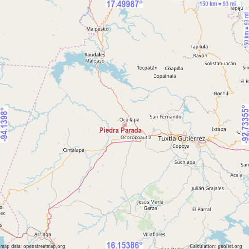
Piedra Parada GPS coordinates[2]
16° 49' 41.016" North, 93° 26' 12.012" West
| Map corner | latitude | longitude |
|---|---|---|
| Upper-left | 17.49987°, | -94.1398° |
| Center: | 16.82806°, | -93.43667° |
| Lower-right: | 16.15386°, | -92.73355° |
| Map W x H: | 149.7×149.7 km | = 93×93mi |
| max Lat: | 32.7° ⇑91.3% North |
| Piedra Parada: | 16.82806° |
| min Lat: | ⇓8.7% South 14.53588° |
| min Long | Piedra Parada | max Long |
| -117.105° | -93.43667° | -86.73105° |
| W 86.7%⇐ | ⇒13.3% E |
Elevation
Elevation of Piedra Parada is 826 m = 2710 ft, and this is 427.7 m = 1403 ft below average elevation for this country.
| Max E: |
3497 m = 11473 ft | 62.9% |
| Avg. | 1253.7 m = 4113 ft | |
| Piedra Parada | 826 m = 2710 ft | |
Min E: |
-1 m = -3 ft | 37.1% |
See also: Mexico elevation on elevation.city.
Geographical zone
Piedra Parada is located in North Torrid zone (between Equator and Tropic of Cancer). Distance of this Northern Tropic circle is 734.8 km =456.6 mi to North.| Distance of | km | miles | from Piedra Parada |
|---|---|---|---|
| North Pole | 8136 | 5055.5 | to North |
| Arctic Circle | 5530.1 | 3436.2 | to North |
| Tropic Cancer | 734.8 | 456.6 | to North |
| Equator | 1871.1 | 1162.6 | to South |


Nearby cities:
15 places around Piedra Parada: (largest is in red/bold)
• Ach'Lum Tierra Nueva
22.1 km =13.7 mi,  335°
335°
• Alfonso Moguel
19.3 km =12 mi,  202°
202°
• Berriozábal
17.9 km =11.1 mi,  100°
100°
• Ciudad Maya
16.2 km =10.1 mi,  127°
127°
• Efraín A. Gutiérrez
16 km =9.9 mi,  68°
68°
• Espinal de Morelos
13.3 km =8.3 mi,  176°
176°
• General Francisco Villa
19.4 km =12.1 mi,  352°
352°
• Las Maravillas
19.2 km =11.9 mi,  40°
40°
• Las Pimientas
13.7 km =8.5 mi, 350°
• Miguel Hidalgo
21.6 km =13.4 mi,  78°
78°
• Monterrey
23.1 km =14.4 mi,  63°
63°
• Nuevo Mezcalapa
16.1 km =10 mi,  355°
355°
• Nuevo San Juan Chamula
11.5 km =7.1 mi,  313°
313°
• Ocozocoautla de Espinosa
9.8 km =6.1 mi,  137°
137°
• Villahermosa (Reymundo Enríquez)
22.5 km =14 mi,  122°
122°
Sources, notices
• [Note1] Compared only with cities in Mexico existing in our database
• [Src1] Map data: © OpenStreetMap contributors (CC-BY-SA)
• [Src2] Other city data from geonames.org with taken over terms of usage.
• [Src3] Geographical zone / Annual Mean Temperature by Robert A. Rohde @ Wikipedia
