Nuevo Mezcalapa geodata
Nuevo Mezcalapa (Chiapas) is a populated place; located in Mexico in America/Mexico_City (GMT-6) time zone. With population of 666 people, there are 13039 cities with bigger population in this country. Compared to other cities in Mexico, 89.3% of cities are located further ↑North; 86.7% of cities are located further ←West and 68.4% of cities have higher elevation than Nuevo Mezcalapa. Note1


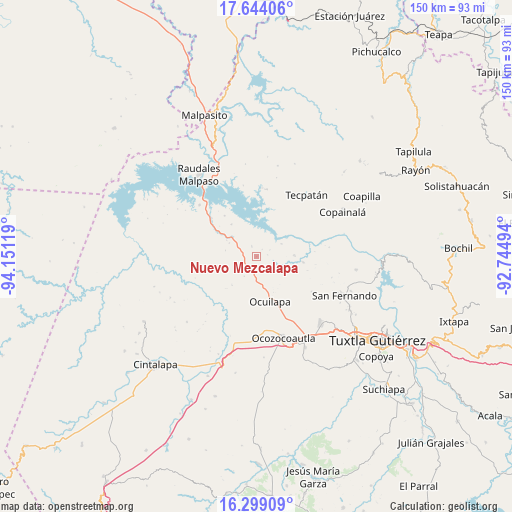
Nuevo Mezcalapa GPS coordinates[2]
16° 58' 22.008" North, 93° 26' 53.016" West
| Map corner | latitude | longitude |
|---|---|---|
| Upper-left | 17.64406°, | -94.15119° |
| Center: | 16.97278°, | -93.44806° |
| Lower-right: | 16.29909°, | -92.74494° |
| Map W x H: | 149.5×149.5 km | = 92.9×92.9mi |
| max Lat: | 32.7° ⇑89.3% North |
| Nuevo Mezcalapa: | 16.97278° |
| min Lat: | ⇓10.7% South 14.53588° |
| min Long | Nuevo Mezcalapa | max Long |
| -117.105° | -93.44806° | -86.73105° |
| W 86.7%⇐ | ⇒13.3% E |
Elevation
Elevation of Nuevo Mezcalapa is 504 m = 1654 ft, and this is 749.7 m = 2460 ft below average elevation for this country.
| Max E: |
3497 m = 11473 ft | 68.4% |
| Avg. | 1253.7 m = 4113 ft | |
| Nuevo Mezcalapa | 504 m = 1654 ft | |
Min E: |
-1 m = -3 ft | 31.6% |
See also: Mexico elevation on elevation.city.
Geographical zone
Nuevo Mezcalapa is located in North Torrid zone (between Equator and Tropic of Cancer). Distance of this Northern Tropic circle is 718.7 km =446.6 mi to North.| Distance of | km | miles | from Nuevo Mezcalapa |
|---|---|---|---|
| North Pole | 8119.9 | 5045.5 | to North |
| Arctic Circle | 5514 | 3426.2 | to North |
| Tropic Cancer | 718.7 | 446.6 | to North |
| Equator | 1887.2 | 1172.7 | to South |


Nearby cities:
15 places around Nuevo Mezcalapa: (largest is in red/bold)
• Ach'Lum Tierra Nueva
9 km =5.6 mi,  296°
296°
• Cuauhtémoc
24.6 km =15.3 mi,  101°
101°
• Efraín A. Gutiérrez
19 km =11.8 mi,  122°
122°
• El Porvenir
23.8 km =14.8 mi,  14°
14°
• General Francisco Villa
3.4 km =2.1 mi,  336°
336°
• Ignacio Zaragoza
14 km =8.7 mi,  47°
47°
• Juan de Grijalva
12.1 km =7.5 mi,  322°
322°
• Las Maravillas
13.7 km =8.5 mi, 96°
• Las Pimientas
2.8 km =1.7 mi,  201°
201°
• Luis Espinoza
19.9 km =12.4 mi, 7°
• Monterrey
22.7 km =14.1 mi,  105°
105°
• Nuevo Naranjo
20.3 km =12.6 mi,  4°
4°
• Nuevo San Juan Chamula
10.9 km =6.8 mi,  220°
220°
• Piedra Parada
16.1 km =10 mi,  175°
175°
• Tecpatán
23.3 km =14.5 mi,  38°
38°
Sources, notices
• [Note1] Compared only with cities in Mexico existing in our database
• [Src1] Map data: © OpenStreetMap contributors (CC-BY-SA)
• [Src2] Other city data from geonames.org with taken over terms of usage.
• [Src3] Geographical zone / Annual Mean Temperature by Robert A. Rohde @ Wikipedia
