Checute geodata
Checute (Chiapas) is a populated place; located in Mexico in America/Mexico_City (GMT-6) time zone. With population of 691 people, there are 12594 cities with bigger population in this country. Compared to other cities in Mexico, 98.9% of cities are located further ↑North; 93.6% of cities are located further ←West and 64.4% of cities have lower elevation than Checute. Note1


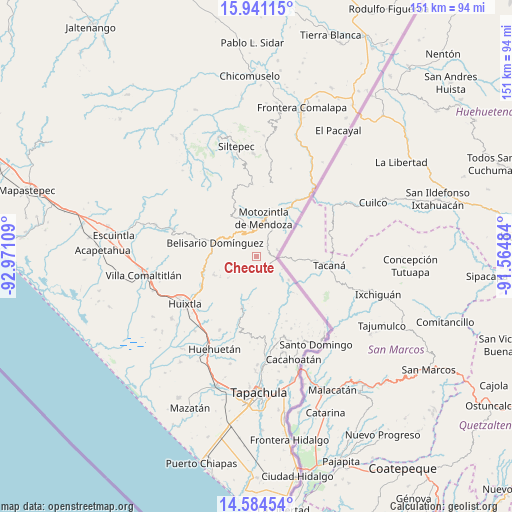
Checute GPS coordinates[2]
15° 15' 50.184" North, 92° 16' 4.656" West
| Map corner | latitude | longitude |
|---|---|---|
| Upper-left | 15.94115°, | -92.97109° |
| Center: | 15.26394°, | -92.26796° |
| Lower-right: | 14.58454°, | -91.56484° |
| Map W x H: | 150.8×150.8 km | = 93.7×93.7mi |
| max Lat: | 32.7° ⇑98.9% North |
| Checute: | 15.26394° |
| min Lat: | ⇓1.1% South 14.53588° |
| min Long | Checute | max Long |
| -117.105° | -92.26796° | -86.73105° |
| W 93.6%⇐ | ⇒6.4% E |
Elevation
Elevation of Checute is 1811 m = 5942 ft, and this is 557.3 m = 1828 ft above average elevation for this country.
| Max E: |
3497 m = 11473 ft | 35.6% |
| Checute | 1811 m 5942 ft | |
| Avg. | 1253.7 m = 4113 ft | |
Min E: |
-1 m = -3 ft | 64.4% |
See also: Mexico elevation on elevation.city.
Geographical zone
Checute is located in North Torrid zone (between Equator and Tropic of Cancer). Distance of this Northern Tropic circle is 908.7 km =564.6 mi to North.| Distance of | km | miles | from Checute |
|---|---|---|---|
| North Pole | 8309.9 | 5163.5 | to North |
| Arctic Circle | 5704 | 3544.3 | to North |
| Tropic Cancer | 908.7 | 564.6 | to North |
| Equator | 1697.2 | 1054.6 | to South |


Nearby cities:
15 places around Checute: (largest is in red/bold)
• Belisario Domínguez
12.7 km =7.9 mi,  288°
288°
• Benito Juárez
12.4 km =7.7 mi,  337°
337°
• Berriozábal
1.7 km =1.1 mi,  257°
257°
• Bijahual
10.7 km =6.6 mi,  128°
128°
• Bremen
10 km =6.2 mi,  240°
240°
• Buenavista
7.1 km =4.4 mi,  314°
314°
• Cantón Sinaí
9.7 km =6 mi,  219°
219°
• El Pinal
10 km =6.2 mi,  119°
119°
• El Tarral
13.6 km =8.5 mi,  246°
246°
• Granados Talcanaque
6.5 km =4 mi,  74°
74°
• Llano Grande
5 km =3.1 mi,  268°
268°
• Motozintla
11.7 km =7.3 mi,  11°
11°
• Niquivil
6 km =3.7 mi,  94°
94°
• Nueva Independencia (Ampliación Calera)
10.5 km =6.5 mi,  233°
233°
• Pavencul
11.7 km =7.3 mi, 125°
Sources, notices
• [Note1] Compared only with cities in Mexico existing in our database
• [Src1] Map data: © OpenStreetMap contributors (CC-BY-SA)
• [Src2] Other city data from geonames.org with taken over terms of usage.
• [Src3] Geographical zone / Annual Mean Temperature by Robert A. Rohde @ Wikipedia
