Llano Grande geodata
Llano Grande (Chiapas) is a populated place; located in Mexico in America/Mexico_City (GMT-6) time zone. With population of 692 people, there are 12576 cities with bigger population in this country. Compared to other cities in Mexico, 98.9% of cities are located further ↑North; 93.3% of cities are located further ←West and 54.8% of cities have lower elevation than Llano Grande. Note1


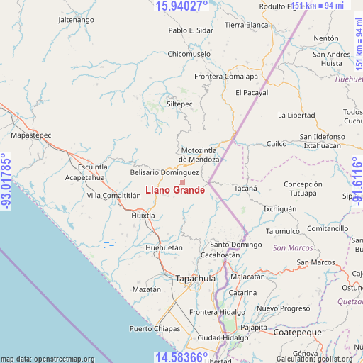
Llano Grande GPS coordinates[2]
15° 15' 47.016" North, 92° 18' 52.992" West
| Map corner | latitude | longitude |
|---|---|---|
| Upper-left | 15.94027°, | -93.01785° |
| Center: | 15.26306°, | -92.31472° |
| Lower-right: | 14.58366°, | -91.6116° |
| Map W x H: | 150.8×150.8 km | = 93.7×93.7mi |
| max Lat: | 32.7° ⇑98.9% North |
| Llano Grande: | 15.26306° |
| min Lat: | ⇓1.1% South 14.53588° |
| min Long | Llano Grande | max Long |
| -117.105° | -92.31472° | -86.73105° |
| W 93.3%⇐ | ⇒6.7% E |
Elevation
Elevation of Llano Grande is 1582 m = 5190 ft, and this is 328.3 m = 1077 ft above average elevation for this country.
| Max E: |
3497 m = 11473 ft | 45.2% |
| Llano Grande | 1582 m 5190 ft | |
| Avg. | 1253.7 m = 4113 ft | |
Min E: |
-1 m = -3 ft | 54.8% |
See also: Mexico elevation on elevation.city.
Geographical zone
Llano Grande is located in North Torrid zone (between Equator and Tropic of Cancer). Distance of this Northern Tropic circle is 908.8 km =564.7 mi to North.| Distance of | km | miles | from Llano Grande |
|---|---|---|---|
| North Pole | 8310 | 5163.6 | to North |
| Arctic Circle | 5704.1 | 3544.4 | to North |
| Tropic Cancer | 908.8 | 564.7 | to North |
| Equator | 1697.1 | 1054.5 | to South |


Nearby cities:
15 places around Llano Grande: (largest is in red/bold)
• Belisario Domínguez
8.1 km =5 mi,  299°
299°
• Benito Juárez
11.5 km =7.1 mi,  0°
0°
• Berriozábal
3.3 km =2.1 mi,  94°
94°
• Bremen
6.1 km =3.8 mi,  217°
217°
• Buenavista
5 km =3.1 mi,  358°
358°
• Cantón Sinaí
7.5 km =4.7 mi,  188°
188°
• Checute
5 km =3.1 mi, 88°
• El Retiro
13.5 km =8.4 mi,  241°
241°
• El Tarral
9.2 km =5.7 mi, 235°
• Granados Talcanaque
11.4 km =7.1 mi,  80°
80°
• Manacal
11.7 km =7.3 mi,  213°
213°
• Niquivil
11 km =6.8 mi, 92°
• Nueva Independencia (Ampliación Calera)
7.1 km =4.4 mi, 208°
• Nueva Tenochtitlán
13.2 km =8.2 mi,  234°
234°
• San José Ixtepec
11.9 km =7.4 mi,  326°
326°
Sources, notices
• [Note1] Compared only with cities in Mexico existing in our database
• [Src1] Map data: © OpenStreetMap contributors (CC-BY-SA)
• [Src2] Other city data from geonames.org with taken over terms of usage.
• [Src3] Geographical zone / Annual Mean Temperature by Robert A. Rohde @ Wikipedia
