Las Golondrinas geodata
Las Golondrinas (Campeche) is a populated place; located in Mexico in America/Merida (GMT-6) time zone. With population of 712 people, there are 12235 cities with bigger population in this country. Compared to other cities in Mexico, 79.8% of cities are located further ↑North; 96.9% of cities are located further ←West and 85.5% of cities have higher elevation than Las Golondrinas. Note1


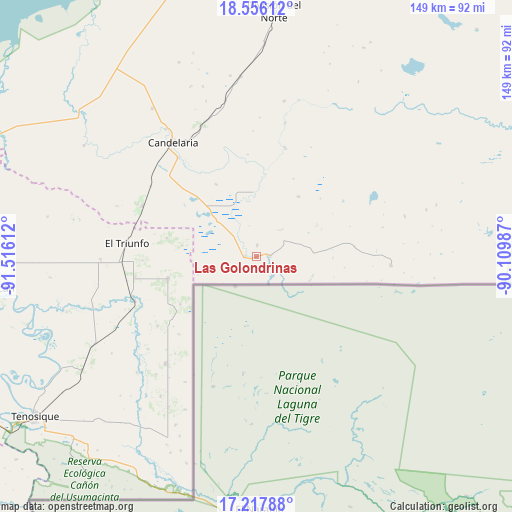
Las Golondrinas GPS coordinates[2]
17° 53' 17.736" North, 90° 48' 46.764" West
| Map corner | latitude | longitude |
|---|---|---|
| Upper-left | 18.55612°, | -91.51612° |
| Center: | 17.88826°, | -90.81299° |
| Lower-right: | 17.21788°, | -90.10987° |
| Map W x H: | 148.8×148.8 km | = 92.5×92.5mi |
| max Lat: | 32.7° ⇑79.8% North |
| Las Golondrinas: | 17.88826° |
| min Lat: | ⇓20.2% South 14.53588° |
| min Long | Las Golondrinas | max Long |
| -117.105° | -90.81299° | -86.73105° |
| W 96.9%⇐ | ⇒3.1% E |
Elevation
Elevation of Las Golondrinas is 41 m = 135 ft, and this is 1212.7 m = 3979 ft below average elevation for this country.
| Max E: |
3497 m = 11473 ft | 85.5% |
| Avg. | 1253.7 m = 4113 ft | |
| Las Golondrinas | 41 m = 135 ft | |
Min E: |
-1 m = -3 ft | 14.5% |
See also: Mexico elevation on elevation.city.
Geographical zone
Las Golondrinas is located in North Torrid zone (between Equator and Tropic of Cancer). Distance of this Northern Tropic circle is 616.9 km =383.3 mi to North.| Distance of | km | miles | from Las Golondrinas |
|---|---|---|---|
| North Pole | 8018.1 | 4982.2 | to North |
| Arctic Circle | 5412.2 | 3363 | to North |
| Tropic Cancer | 616.9 | 383.3 | to North |
| Equator | 1989 | 1235.9 | to South |


Nearby cities:
15 places around Las Golondrinas: (largest is in red/bold)
• Capitán Felipe Castellanos Díaz (San Pedro)
37.7 km =23.4 mi,  250°
250°
• Cuauhtémoc
26.4 km =16.4 mi,  256°
256°
• El Capulín
35.4 km =22 mi,  235°
235°
• El Mical
26.9 km =16.7 mi, 256°
• El Naranjito
35.9 km =22.3 mi, 260°
• El Naranjo
36.3 km =22.6 mi,  294°
294°
• El Pichi
22 km =13.7 mi,  278°
278°
• Ingeniero Emilio López Zamora
27.1 km =16.8 mi, 255°
• Los Cenotes
36.9 km =22.9 mi,  220°
220°
• Lázaro Cárdenas
3.2 km =2 mi,  1°
1°
• Miguel Hidalgo y Costilla
3.6 km =2.2 mi,  270°
270°
• Ojo de Agua
33.4 km =20.8 mi, 268°
• Pablo García
24.2 km =15 mi,  330°
330°
• Quetzalcóatl (Cuatro Poblados)
26.6 km =16.5 mi, 255°
• Venustiano Carranza
36.7 km =22.8 mi,  321°
321°
Sources, notices
• [Note1] Compared only with cities in Mexico existing in our database
• [Src1] Map data: © OpenStreetMap contributors (CC-BY-SA)
• [Src2] Other city data from geonames.org with taken over terms of usage.
• [Src3] Geographical zone / Annual Mean Temperature by Robert A. Rohde @ Wikipedia
