Chacté geodata
Chacté (Chiapas) is a populated place; located in Mexico in America/Mexico_City (GMT-6) time zone. With population of 670 people, there are 12949 cities with bigger population in this country. Compared to other cities in Mexico, 89.8% of cities are located further ↑North; 93.1% of cities are located further ←West and 63.3% of cities have higher elevation than Chacté. Note1


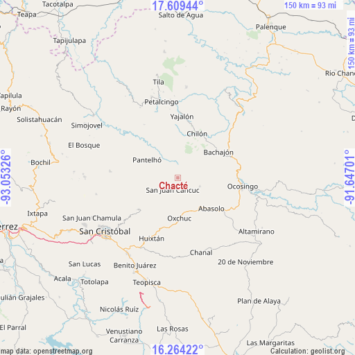
Chacté GPS coordinates[2]
16° 56' 16.908" North, 92° 21' 0.468" West
| Map corner | latitude | longitude |
|---|---|---|
| Upper-left | 17.60944°, | -93.05326° |
| Center: | 16.93803°, | -92.35013° |
| Lower-right: | 16.26422°, | -91.64701° |
| Map W x H: | 149.6×149.6 km | = 93×93mi |
| max Lat: | 32.7° ⇑89.8% North |
| Chacté: | 16.93803° |
| min Lat: | ⇓10.2% South 14.53588° |
| min Long | Chacté | max Long |
| -117.105° | -92.35013° | -86.73105° |
| W 93.1%⇐ | ⇒6.9% E |
Elevation
Elevation of Chacté is 796 m = 2612 ft, and this is 457.7 m = 1502 ft below average elevation for this country.
| Max E: |
3497 m = 11473 ft | 63.3% |
| Avg. | 1253.7 m = 4113 ft | |
| Chacté | 796 m = 2612 ft | |
Min E: |
-1 m = -3 ft | 36.7% |
See also: Mexico elevation on elevation.city.
Geographical zone
Chacté is located in North Torrid zone (between Equator and Tropic of Cancer). Distance of this Northern Tropic circle is 722.6 km =449 mi to North.| Distance of | km | miles | from Chacté |
|---|---|---|---|
| North Pole | 8123.7 | 5047.8 | to North |
| Arctic Circle | 5517.8 | 3428.6 | to North |
| Tropic Cancer | 722.6 | 449 | to North |
| Equator | 1883.3 | 1170.2 | to South |


Nearby cities:
15 places around Chacté: (largest is in red/bold)
• Baquelchán
5.4 km =3.4 mi,  359°
359°
• Chojchow
3.4 km =2.1 mi,  196°
196°
• Cruztón
9.3 km =5.8 mi,  277°
277°
• El Pozo
6.8 km =4.2 mi,  253°
253°
• El Tzay
9.2 km =5.7 mi,  154°
154°
• Guaquitepec
8.1 km =5 mi,  54°
54°
• La Frontera Uno
7 km =4.3 mi,  95°
95°
• La Palma Uno
4.7 km =2.9 mi,  331°
331°
• Oniltic
5.3 km =3.3 mi,  310°
310°
• San Antonio Bulujib
8.7 km =5.4 mi,  41°
41°
• San Juan Cancuc
5.5 km =3.4 mi, 202°
• Tenango
7.8 km =4.8 mi,  294°
294°
• Tzuluwitz
7.7 km =4.8 mi,  224°
224°
• Tzunjok
4 km =2.5 mi, 285°
• Yocwitz
6.5 km =4 mi,  324°
324°
Sources, notices
• [Note1] Compared only with cities in Mexico existing in our database
• [Src1] Map data: © OpenStreetMap contributors (CC-BY-SA)
• [Src2] Other city data from geonames.org with taken over terms of usage.
• [Src3] Geographical zone / Annual Mean Temperature by Robert A. Rohde @ Wikipedia
