San Juan Cancuc geodata
San Juan Cancuc (Chiapas) is a seat of a second-order administrative division; located in Mexico in America/Mexico_City (GMT-6) time zone. With population of 6,327 people, there are 1469 cities with bigger population in this country. Compared to other cities in Mexico, 90.4% of cities are located further ↑North; 93% of cities are located further ←West and 50.3% of cities have higher elevation than San Juan Cancuc. Note1


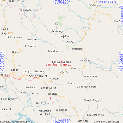
San Juan Cancuc GPS coordinates[2]
16° 53' 33.792" North, 92° 22' 12.216" West
| Map corner | latitude | longitude |
|---|---|---|
| Upper-left | 17.56429°, | -93.07319° |
| Center: | 16.89272°, | -92.37006° |
| Lower-right: | 16.21875°, | -91.66694° |
| Map W x H: | 149.6×149.6 km | = 93×93mi |
| max Lat: | 32.7° ⇑90.4% North |
| San Juan Cancuc: | 16.89272° |
| min Lat: | ⇓9.6% South 14.53588° |
| min Long | San Juan Cancuc | max Long |
| -117.105° | -92.37006° | -86.73105° |
| W 93%⇐ | ⇒7% E |
Elevation
Elevation of San Juan Cancuc is 1415 m = 4642 ft, and this is 161.3 m = 529 ft above average elevation for this country.
| Max E: |
3497 m = 11473 ft | 50.3% |
| San Juan Cancuc | 1415 m 4642 ft | |
| Avg. | 1253.7 m = 4113 ft | |
Min E: |
-1 m = -3 ft | 49.7% |
See also: Mexico elevation on elevation.city.
Geographical zone
San Juan Cancuc is located in North Torrid zone (between Equator and Tropic of Cancer). Distance of this Northern Tropic circle is 727.6 km =452.1 mi to North.| Distance of | km | miles | from San Juan Cancuc |
|---|---|---|---|
| North Pole | 8128.8 | 5051 | to North |
| Arctic Circle | 5522.9 | 3431.8 | to North |
| Tropic Cancer | 727.6 | 452.1 | to North |
| Equator | 1878.3 | 1167.1 | to South |


Nearby cities:
15 places around San Juan Cancuc: (largest is in red/bold)
• Chacté
5.5 km =3.4 mi,  22°
22°
• Chiloljá
5.9 km =3.7 mi,  261°
261°
• Chojchow
2.1 km =1.3 mi,  32°
32°
• Cruz Pilar
8.6 km =5.3 mi,  281°
281°
• Cruztón
6.5 km =4 mi,  148°
148°
• El Pozo
5.4 km =3.4 mi,  304°
304°
• El Tzay
7 km =4.3 mi,  117°
117°
• La Frontera
6 km =3.7 mi,  212°
212°
• Lelenchij
7.3 km =4.5 mi,  217°
217°
• Nailchén
7.2 km =4.5 mi,  251°
251°
• Tzametal
5.5 km =3.4 mi, 246°
• Tzuluwitz
3.3 km =2.1 mi, 262°
• Tzunjok
6.3 km =3.9 mi,  343°
343°
• Tzunún
5.9 km =3.7 mi,  184°
184°
• Yetzucum
7.9 km =4.9 mi, 263°
Sources, notices
• [Note1] Compared only with cities in Mexico existing in our database
• [Src1] Map data: © OpenStreetMap contributors (CC-BY-SA)
• [Src2] Other city data from geonames.org with taken over terms of usage.
• [Src3] Geographical zone / Annual Mean Temperature by Robert A. Rohde @ Wikipedia
