Plan de Guadalupe geodata
Plan de Guadalupe (Puebla) is a populated place; located in Mexico in America/Mexico_City (GMT-6) time zone. With population of 932 people, there are 9352 cities with bigger population in this country. Compared to other cities in Mexico, 53% of cities are located further ↓South; 68.9% of cities are located further ←West and 83.3% of cities have lower elevation than Plan de Guadalupe. Note1


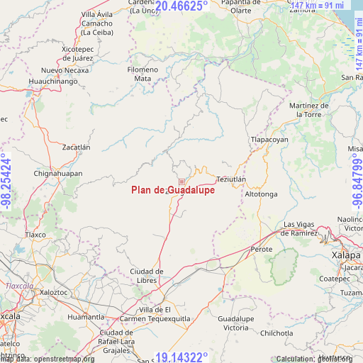
Plan de Guadalupe GPS coordinates[2]
19° 48' 21.996" North, 97° 33' 3.996" West
| Map corner | latitude | longitude |
|---|---|---|
| Upper-left | 20.46625°, | -98.25424° |
| Center: | 19.80611°, | -97.55111° |
| Lower-right: | 19.14322°, | -96.84799° |
| Map W x H: | 147.1×147.1 km | = 91.4×91.4mi |
| max Lat: | 32.7° ⇑47% North |
| Plan de Guadalupe: | 19.80611° |
| min Lat: | ⇓53% South 14.53588° |
| min Long | Plan de Guadalu | max Long |
| -117.105° | -97.55111° | -86.73105° |
| W 68.9%⇐ | ⇒31.1% E |
Elevation
Elevation of Plan de Guadalupe is 2227 m = 7306 ft, and this is 973.3 m = 3193 ft above average elevation for this country.
| Max E: |
3497 m = 11473 ft | 16.7% |
| Plan de Guadalupe | 2227 m 7306 ft | |
| Avg. | 1253.7 m = 4113 ft | |
Min E: |
-1 m = -3 ft | 83.3% |
See also: Mexico elevation on elevation.city.
Geographical zone
Plan de Guadalupe is located in North Torrid zone (between Equator and Tropic of Cancer). Distance of this Northern Tropic circle is 403.7 km =250.8 mi to North.| Distance of | km | miles | from Plan de Guadalupe |
|---|---|---|---|
| North Pole | 7804.8 | 4849.7 | to North |
| Arctic Circle | 5198.9 | 3230.4 | to North |
| Tropic Cancer | 403.7 | 250.8 | to North |
| Equator | 2202.2 | 1368.4 | to South |


Nearby cities:
15 places around Plan de Guadalupe: (largest is in red/bold)
• Acuaco
5 km =3.1 mi,  196°
196°
• Atalpan
4.3 km =2.7 mi,  347°
347°
• Cuacuilco
5.1 km =3.2 mi,  8°
8°
• Cuautlamingo
4.9 km =3 mi,  163°
163°
• El Mirador
4.2 km =2.6 mi,  60°
60°
• El Molino
3.2 km =2 mi,  284°
284°
• Francisco I. Madero
4.7 km =2.9 mi,  255°
255°
• Héroes del Cinco de Mayo
5.1 km =3.2 mi,  289°
289°
• Nexticapan
2.4 km =1.5 mi, 352°
• Ocotlán de Betancourt
1.8 km =1.1 mi,  122°
122°
• San José Buenavista
3.9 km =2.4 mi, 202°
• Tatauzoquico
3.5 km =2.2 mi,  45°
45°
• Texocoyohuac
5.2 km =3.2 mi,  232°
232°
• Xonocuautla
4.1 km =2.5 mi, 117°
• Zaragoza
3.9 km =2.4 mi,  186°
186°
Sources, notices
• [Note1] Compared only with cities in Mexico existing in our database
• [Src1] Map data: © OpenStreetMap contributors (CC-BY-SA)
• [Src2] Other city data from geonames.org with taken over terms of usage.
• [Src3] Geographical zone / Annual Mean Temperature by Robert A. Rohde @ Wikipedia
