Palmar de Bravo geodata
Palmar de Bravo (Puebla) is a seat of a second-order administrative division; located in Mexico in America/Mexico_City (GMT-6) time zone. With population of 4,870 people, there are 1897 cities with bigger population in this country. Compared to other cities in Mexico, 68.1% of cities are located further ↑North; 69% of cities are located further ←West and 82.4% of cities have lower elevation than Palmar de Bravo. Note1


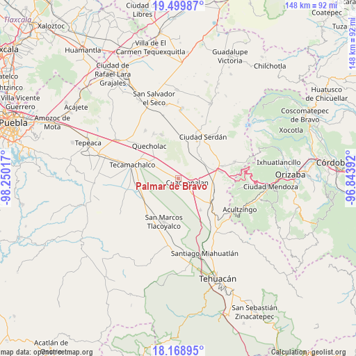
Palmar de Bravo GPS coordinates[2]
18° 50' 8.628" North, 97° 32' 49.344" West
| Map corner | latitude | longitude |
|---|---|---|
| Upper-left | 19.49987°, | -98.25017° |
| Center: | 18.83573°, | -97.54704° |
| Lower-right: | 18.16895°, | -96.84392° |
| Map W x H: | 148×148 km | = 92×92mi |
| max Lat: | 32.7° ⇑68.1% North |
| Palmar de Bravo: | 18.83573° |
| min Lat: | ⇓31.9% South 14.53588° |
| min Long | Palmar de Bravo | max Long |
| -117.105° | -97.54704° | -86.73105° |
| W 69%⇐ | ⇒31% E |
Elevation
Elevation of Palmar de Bravo is 2199 m = 7215 ft, and this is 945.3 m = 3101 ft above average elevation for this country.
| Max E: |
3497 m = 11473 ft | 17.6% |
| Palmar de Bravo | 2199 m 7215 ft | |
| Avg. | 1253.7 m = 4113 ft | |
Min E: |
-1 m = -3 ft | 82.4% |
See also: Mexico elevation on elevation.city.
Geographical zone
Palmar de Bravo is located in North Torrid zone (between Equator and Tropic of Cancer). Distance of this Northern Tropic circle is 511.6 km =317.9 mi to North.| Distance of | km | miles | from Palmar de Bravo |
|---|---|---|---|
| North Pole | 7912.7 | 4916.7 | to North |
| Arctic Circle | 5306.8 | 3297.5 | to North |
| Tropic Cancer | 511.6 | 317.9 | to North |
| Equator | 2094.3 | 1301.3 | to South |


Nearby cities:
15 places around Palmar de Bravo: (largest is in red/bold)
• Bellavista de Victoria (San José Bellavista)
4.5 km =2.8 mi,  4°
4°
• Cuacnopalan
4.3 km =2.7 mi,  118°
118°
• Cuesta Blanca
8.4 km =5.2 mi,  82°
82°
• Guadalupe Enríquez
7.7 km =4.8 mi,  326°
326°
• Jesús Nazareno
9.2 km =5.7 mi,  299°
299°
• La Purísima
2.8 km =1.7 mi,  256°
256°
• Las Palmas
11.4 km =7.1 mi,  20°
20°
• Palmarito Tochapan
12.1 km =7.5 mi,  307°
307°
• San Bartolomé
11.9 km =7.4 mi,  320°
320°
• San Isidro Monterrosas
3.8 km =2.4 mi, 308°
• San Martín Esperilla
11.5 km =7.1 mi,  180°
180°
• San Pedro Temamatla
10.6 km =6.6 mi, 20°
• Santa Cruz Monterrosas
4.8 km =3 mi,  340°
340°
• Tehuitzo
11.5 km =7.1 mi,  96°
96°
• Xaltepec
8.2 km =5.1 mi, 308°
Sources, notices
• [Note1] Compared only with cities in Mexico existing in our database
• [Src1] Map data: © OpenStreetMap contributors (CC-BY-SA)
• [Src2] Other city data from geonames.org with taken over terms of usage.
• [Src3] Geographical zone / Annual Mean Temperature by Robert A. Rohde @ Wikipedia
