Guadalupe Enríquez geodata
Guadalupe Enríquez (Puebla) is a populated place; located in Mexico in America/Mexico_City (GMT-6) time zone. With population of 1,757 people, there are 4939 cities with bigger population in this country. Compared to other cities in Mexico, 67.2% of cities are located further ↑North; 68.6% of cities are located further ←West and 83.1% of cities have lower elevation than Guadalupe Enríquez. Note1


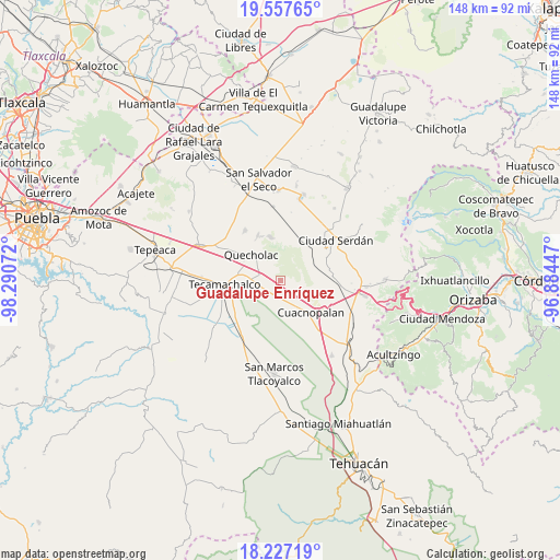
Guadalupe Enríquez GPS coordinates[2]
18° 53' 37.464" North, 97° 35' 15.324" West
| Map corner | latitude | longitude |
|---|---|---|
| Upper-left | 19.55765°, | -98.29072° |
| Center: | 18.89374°, | -97.58759° |
| Lower-right: | 18.22719°, | -96.88447° |
| Map W x H: | 147.9×147.9 km | = 91.9×91.9mi |
| max Lat: | 32.7° ⇑67.2% North |
| Guadalupe Enríquez: | 18.89374° |
| min Lat: | ⇓32.8% South 14.53588° |
| min Long | Guadalupe Enrí | max Long |
| -117.105° | -97.58759° | -86.73105° |
| W 68.6%⇐ | ⇒31.4% E |
Elevation
Elevation of Guadalupe Enríquez is 2218 m = 7277 ft, and this is 964.3 m = 3164 ft above average elevation for this country.
| Max E: |
3497 m = 11473 ft | 16.9% |
| Guadalupe Enríquez | 2218 m 7277 ft | |
| Avg. | 1253.7 m = 4113 ft | |
Min E: |
-1 m = -3 ft | 83.1% |
See also: Mexico elevation on elevation.city.
Geographical zone
Guadalupe Enríquez is located in North Torrid zone (between Equator and Tropic of Cancer). Distance of this Northern Tropic circle is 505.1 km =313.9 mi to North.| Distance of | km | miles | from Guadalupe Enríquez |
|---|---|---|---|
| North Pole | 7906.3 | 4912.7 | to North |
| Arctic Circle | 5300.4 | 3293.5 | to North |
| Tropic Cancer | 505.1 | 313.9 | to North |
| Equator | 2100.8 | 1305.4 | to South |


Nearby cities:
15 places around Guadalupe Enríquez: (largest is in red/bold)
• Bellavista de Victoria (San José Bellavista)
5 km =3.1 mi,  112°
112°
• Francisco I. Madero
10.8 km =6.7 mi,  291°
291°
• Jesús Nazareno
4.2 km =2.6 mi,  243°
243°
• La Purísima
7.3 km =4.5 mi,  167°
167°
• Las Palmas
9.3 km =5.8 mi,  62°
62°
• Palmar de Bravo
7.7 km =4.8 mi,  146°
146°
• Palmarito Tochapan
5.4 km =3.4 mi,  279°
279°
• Quecholac
10.1 km =6.3 mi,  312°
312°
• San Bartolomé
4.3 km =2.7 mi, 308°
• San Cayetano
5.6 km =3.5 mi,  301°
301°
• San Isidro Monterrosas
4.3 km =2.7 mi,  162°
162°
• San Pedro Temamatla
8.7 km =5.4 mi,  66°
66°
• Santa Cruz Monterrosas
3.3 km =2.1 mi,  126°
126°
• Tuzuapan
8.4 km =5.2 mi, 275°
• Xaltepec
2.6 km =1.6 mi, 238°
Sources, notices
• [Note1] Compared only with cities in Mexico existing in our database
• [Src1] Map data: © OpenStreetMap contributors (CC-BY-SA)
• [Src2] Other city data from geonames.org with taken over terms of usage.
• [Src3] Geographical zone / Annual Mean Temperature by Robert A. Rohde @ Wikipedia
