La Cruz del Palmar geodata
La Cruz del Palmar (Guanajuato) is a populated place; located in Mexico in America/Mexico_City (GMT-6) time zone. With population of 1,009 people, there are 8636 cities with bigger population in this country. Compared to other cities in Mexico, 76% of cities are located further ↓South; 72.2% of cities are located further →East and 66.8% of cities have lower elevation than La Cruz del Palmar. Note1


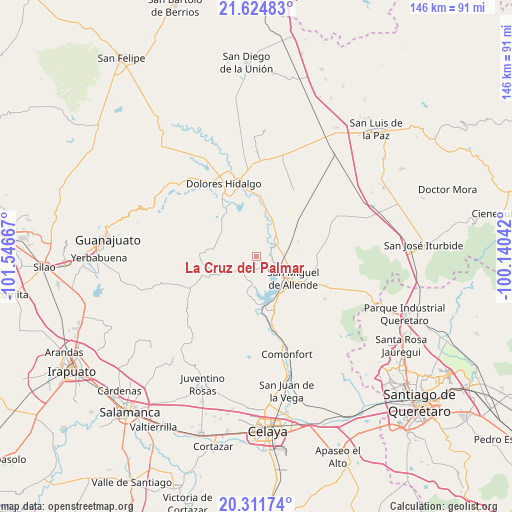
La Cruz del Palmar GPS coordinates[2]
20° 58' 11.028" North, 100° 50' 36.744" West
| Map corner | latitude | longitude |
|---|---|---|
| Upper-left | 21.62483°, | -101.54667° |
| Center: | 20.96973°, | -100.84354° |
| Lower-right: | 20.31174°, | -100.14042° |
| Map W x H: | 146×146 km | = 90.7×90.7mi |
| max Lat: | 32.7° ⇑24% North |
| La Cruz del Palmar: | 20.96973° |
| min Lat: | ⇓76% South 14.53588° |
| min Long | La Cruz del Pal | max Long |
| -117.105° | -100.84354° | -86.73105° |
| W 27.8%⇐ | ⇒72.2% E |
Elevation
Elevation of La Cruz del Palmar is 1866 m = 6122 ft, and this is 612.3 m = 2009 ft above average elevation for this country.
| Max E: |
3497 m = 11473 ft | 33.2% |
| La Cruz del Palmar | 1866 m 6122 ft | |
| Avg. | 1253.7 m = 4113 ft | |
Min E: |
-1 m = -3 ft | 66.8% |
See also: Mexico elevation on elevation.city.
Geographical zone
La Cruz del Palmar is located in North Torrid zone (between Equator and Tropic of Cancer). Distance of this Northern Tropic circle is 274.3 km =170.4 mi to North.| Distance of | km | miles | from La Cruz del Palmar |
|---|---|---|---|
| North Pole | 7675.4 | 4769.3 | to North |
| Arctic Circle | 5069.6 | 3150.1 | to North |
| Tropic Cancer | 274.3 | 170.4 | to North |
| Equator | 2331.6 | 1448.8 | to South |


Nearby cities:
15 places around La Cruz del Palmar: (largest is in red/bold)
• Colonia San Luis Rey
11.8 km =7.3 mi,  108°
108°
• Don Francisco
10.8 km =6.7 mi,  226°
226°
• Esperanza
7.9 km =4.9 mi,  131°
131°
• Insurgentes
11.5 km =7.1 mi, 107°
• La Cieneguita
6.2 km =3.9 mi, 114°
• La Lomita
11.8 km =7.3 mi, 107°
• La Palma
9 km =5.6 mi,  47°
47°
• Lomas de San José
7.9 km =4.9 mi,  102°
102°
• Los Galvan
11.3 km =7 mi,  22°
22°
• Los López
7.1 km =4.4 mi,  124°
124°
• Nigromante
6.6 km =4.1 mi, 97°
• Rancho Viejo
9.4 km =5.8 mi, 52°
• San Lucas
11.6 km =7.2 mi,  236°
236°
• San Miguel Viejo
9.5 km =5.9 mi,  136°
136°
• Santa Cecilia
11.8 km =7.3 mi, 110°
Sources, notices
• [Note1] Compared only with cities in Mexico existing in our database
• [Src1] Map data: © OpenStreetMap contributors (CC-BY-SA)
• [Src2] Other city data from geonames.org with taken over terms of usage.
• [Src3] Geographical zone / Annual Mean Temperature by Robert A. Rohde @ Wikipedia
