San Nicolás Cebolletas (Cebolletas) geodata
San Nicolás Cebolletas (Cebolletas) (Hidalgo) is a populated place; located in Mexico in America/Mexico_City (GMT-6) time zone. With population of 637 people, there are 13597 cities with bigger population in this country. Compared to other cities in Mexico, 60.5% of cities are located further ↓South; 59.3% of cities are located further ←West and 79.7% of cities have lower elevation than San Nicolás Cebolletas (Cebolletas). Note1
Current local time in San Nicolás Cebolletas (Cebolletas):
07:23 AM, MondayDifference from your time zone: hours


San Nicolás Cebolletas (Cebolletas) GPS coordinates[2]
20° 9' 37.008" North, 98° 20' 40.992" West
| Map corner | latitude | longitude |
|---|---|---|
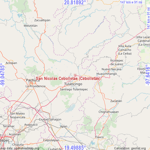
| Upper-left | 20.81892°, | -99.04785° |
| Center: | 20.16028°, | -98.34472° |
| Lower-right: | 19.49885°, | -97.6416° |
| Map W x H: | 146.8×146.8 km | = 91.2×91.2mi |
| max Lat: | 32.7° ⇑39.5% North |
| San Nicolás Cebolletas (Cebolletas): | 20.16028° |
| min Lat: | ⇓60.5% South 14.53588° |
| min Long | San Nicolás Ce | max Long |
| -117.105° | -98.34472° | -86.73105° |
| W 59.3%⇐ | ⇒40.7% E |
Elevation
Elevation of San Nicolás Cebolletas (Cebolletas) is 2134 m = 7001 ft, and this is 880.3 m = 2888 ft above average elevation for this country.
| Max E: |
3497 m = 11473 ft | 20.3% |
| San Nicolás Cebolletas (Cebolletas) | 2134 m 7001 ft | |
| Avg. | 1253.7 m = 4113 ft | |
Min E: |
-1 m = -3 ft | 79.7% |
See also: Mexico elevation on elevation.city.
Geographical zone
San Nicolás Cebolletas (Cebolletas) is located in North Torrid zone (between Equator and Tropic of Cancer). Distance of this Northern Tropic circle is 364.3 km =226.4 mi to North.| Distance of | km | miles | from San Nicolás Cebolletas (Cebolletas) |
|---|---|---|---|
| North Pole | 7765.4 | 4825.2 | to North |
| Arctic Circle | 5159.6 | 3206 | to North |
| Tropic Cancer | 364.3 | 226.4 | to North |
| Equator | 2241.6 | 1392.9 | to South |


Nearby cities:
15 places around San Nicolás Cebolletas (Cebolletas): (largest is in red/bold)
• Colonia 28 de Mayo (Santa Rosa)
4.8 km =3 mi,  277°
277°
• El Acocul
7.4 km =4.6 mi,  338°
338°
• Metepec
8.9 km =5.5 mi,  15°
15°
• Palo Gordo
7.3 km =4.5 mi,  32°
32°
• Parque Urbano Napateco
2 km =1.2 mi,  168°
168°
• Rincones de la Hacienda
7.4 km =4.6 mi,  233°
233°
• San Nicolás el Chico
8.5 km =5.3 mi,  212°
212°
• San Pedro Tlachichilco
8.4 km =5.2 mi,  89°
89°
• Santa Ana Hueytlalpan
3.8 km =2.4 mi,  64°
64°
• Santa María Asunción
7.8 km =4.8 mi, 94°
• Santa María el Chico
8 km =5 mi,  222°
222°
• Tepaltzingo
7.1 km =4.4 mi,  110°
110°
• Tulancingo
8.7 km =5.4 mi,  192°
192°
• Vicente Guerrero
7.2 km =4.5 mi,  312°
312°
• Viveros de la Loma
6.5 km =4 mi,  175°
175°
Sources, notices
• [Note1] Compared only with cities in Mexico existing in our database
• [Src1] Map data: © OpenStreetMap contributors (CC-BY-SA)
• [Src2] Other city data from geonames.org with taken over terms of usage.
• [Src3] Geographical zone / Annual Mean Temperature by Robert A. Rohde @ Wikipedia
