San Pedro Tlachichilco geodata
San Pedro Tlachichilco (Hidalgo) is a populated place; located in Mexico in America/Mexico_City (GMT-6) time zone. With population of 1,896 people, there are 4591 cities with bigger population in this country. Compared to other cities in Mexico, 60.5% of cities are located further ↓South; 60.4% of cities are located further ←West and 82.3% of cities have lower elevation than San Pedro Tlachichilco. Note1
Current local time in San Pedro Tlachichilco:
08:32 AM, WednesdayDifference from your time zone: hours


San Pedro Tlachichilco GPS coordinates[2]
20° 9' 39.924" North, 98° 15' 50.94" West
| Map corner | latitude | longitude |
|---|---|---|
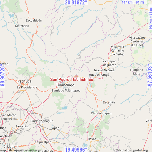
| Upper-left | 20.81972°, | -98.96728° |
| Center: | 20.16109°, | -98.26415° |
| Lower-right: | 19.49966°, | -97.56103° |
| Map W x H: | 146.8×146.8 km | = 91.2×91.2mi |
| max Lat: | 32.7° ⇑39.5% North |
| San Pedro Tlachichilco: | 20.16109° |
| min Lat: | ⇓60.5% South 14.53588° |
| min Long | San Pedro Tlach | max Long |
| -117.105° | -98.26415° | -86.73105° |
| W 60.4%⇐ | ⇒39.6% E |
Elevation
Elevation of San Pedro Tlachichilco is 2194 m = 7198 ft, and this is 940.3 m = 3085 ft above average elevation for this country.
| Max E: |
3497 m = 11473 ft | 17.7% |
| San Pedro Tlachichilco | 2194 m 7198 ft | |
| Avg. | 1253.7 m = 4113 ft | |
Min E: |
-1 m = -3 ft | 82.3% |
See also: Mexico elevation on elevation.city.
Geographical zone
San Pedro Tlachichilco is located in North Torrid zone (between Equator and Tropic of Cancer). Distance of this Northern Tropic circle is 364.2 km =226.3 mi to North.| Distance of | km | miles | from San Pedro Tlachichilco |
|---|---|---|---|
| North Pole | 7765.4 | 4825.2 | to North |
| Arctic Circle | 5159.5 | 3206 | to North |
| Tropic Cancer | 364.2 | 226.3 | to North |
| Equator | 2241.7 | 1392.9 | to South |


Nearby cities:
15 places around San Pedro Tlachichilco: (largest is in red/bold)
• Acaxochitlán
6.5 km =4 mi,  93°
93°
• Barrio Cuaunepantla
3.8 km =2.4 mi,  96°
96°
• Barrio Techachalco
5.2 km =3.2 mi, 87°
• Palo Gordo
7.5 km =4.7 mi,  323°
323°
• Parque Urbano Napateco
8.3 km =5.2 mi,  255°
255°
• San Mateo
3 km =1.9 mi,  37°
37°
• Santa Ana Hueytlalpan
5.2 km =3.2 mi,  286°
286°
• Santa Ana Tzacuala
7.5 km =4.7 mi,  56°
56°
• Santa María Asunción
0.9 km =0.6 mi,  224°
224°
• Tepaltzingo
3.1 km =1.9 mi, 215°
• Tlacpac
5.1 km =3.2 mi,  105°
105°
• Tlaltegco (Venta Quemada)
7.8 km =4.8 mi, 103°
• Tlatzintla
7.8 km =4.8 mi, 93°
• Tonalixco
7.9 km =4.9 mi,  6°
6°
• Zacacuautla
7 km =4.3 mi,  31°
31°
Sources, notices
• [Note1] Compared only with cities in Mexico existing in our database
• [Src1] Map data: © OpenStreetMap contributors (CC-BY-SA)
• [Src2] Other city data from geonames.org with taken over terms of usage.
• [Src3] Geographical zone / Annual Mean Temperature by Robert A. Rohde @ Wikipedia
