Jalapa del Valle geodata
Jalapa del Valle (Oaxaca) is a populated place; located in Mexico in America/Mexico_City (GMT-6) time zone. With population of 603 people, there are 14266 cities with bigger population in this country. Compared to other cities in Mexico, 88% of cities are located further ↑North; 76.3% of cities are located further ←West and 60.6% of cities have lower elevation than Jalapa del Valle. Note1


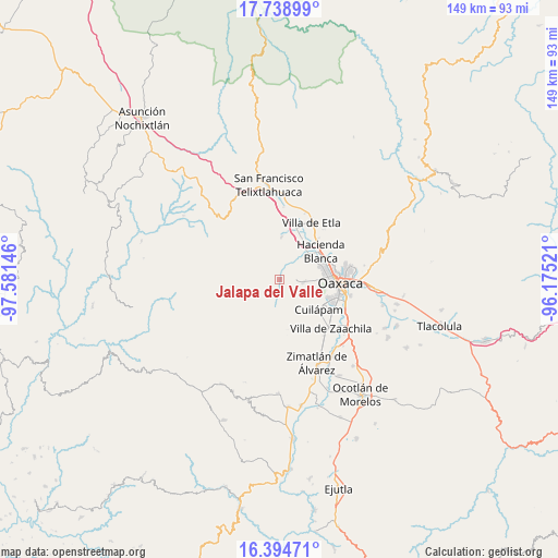
Jalapa del Valle GPS coordinates[2]
17° 4' 5.016" North, 96° 52' 41.988" West
| Map corner | latitude | longitude |
|---|---|---|
| Upper-left | 17.73899°, | -97.58146° |
| Center: | 17.06806°, | -96.87833° |
| Lower-right: | 16.39471°, | -96.17521° |
| Map W x H: | 149.5×149.5 km | = 92.9×92.9mi |
| max Lat: | 32.7° ⇑88% North |
| Jalapa del Valle: | 17.06806° |
| min Lat: | ⇓12% South 14.53588° |
| min Long | Jalapa del Vall | max Long |
| -117.105° | -96.87833° | -86.73105° |
| W 76.3%⇐ | ⇒23.7% E |
Elevation
Elevation of Jalapa del Valle is 1735 m = 5692 ft, and this is 481.3 m = 1579 ft above average elevation for this country.
| Max E: |
3497 m = 11473 ft | 39.4% |
| Jalapa del Valle | 1735 m 5692 ft | |
| Avg. | 1253.7 m = 4113 ft | |
Min E: |
-1 m = -3 ft | 60.6% |
See also: Mexico elevation on elevation.city.
Geographical zone
Jalapa del Valle is located in North Torrid zone (between Equator and Tropic of Cancer). Distance of this Northern Tropic circle is 708.1 km =440 mi to North.| Distance of | km | miles | from Jalapa del Valle |
|---|---|---|---|
| North Pole | 8109.3 | 5038.9 | to North |
| Arctic Circle | 5503.4 | 3419.7 | to North |
| Tropic Cancer | 708.1 | 440 | to North |
| Equator | 1897.8 | 1179.2 | to South |


Nearby cities:
15 places around Jalapa del Valle: (largest is in red/bold)
• Duraznal
9.3 km =5.8 mi,  269°
269°
• Fraccionamiento Real Santa María
10.7 km =6.6 mi,  58°
58°
• Fraccionamiento Riberas de San Jerónimo
11.8 km =7.3 mi,  65°
65°
• Guadalupe Hidalgo
11.5 km =7.1 mi,  38°
38°
• La Cañada
10.7 km =6.6 mi,  88°
88°
• Loma Bonita (Paraje Jagüey)
9.5 km =5.9 mi, 92°
• San Andrés Ixtlahuaca
5.5 km =3.4 mi, 86°
• San Antonio Arrazola
9.9 km =6.2 mi,  108°
108°
• San Felipe Tejalápam
5.5 km =3.4 mi,  28°
28°
• San Francisco Javier
11.6 km =7.2 mi, 112°
• San Lorenzo Cacaotepec
10.4 km =6.5 mi,  50°
50°
• San Pablo Cuatro Venados
9.8 km =6.1 mi,  187°
187°
• San Pedro Ixtlahuaca
6.4 km =4 mi, 94°
• Santa María Atzompa
11.4 km =7.1 mi, 70°
• Santo Tomás Mazaltepec
11.6 km =7.2 mi,  2°
2°
Sources, notices
• [Note1] Compared only with cities in Mexico existing in our database
• [Src1] Map data: © OpenStreetMap contributors (CC-BY-SA)
• [Src2] Other city data from geonames.org with taken over terms of usage.
• [Src3] Geographical zone / Annual Mean Temperature by Robert A. Rohde @ Wikipedia
