San Felipe Tejalápam geodata
San Felipe Tejalápam (Oaxaca) is a populated place; located in Mexico in America/Mexico_City (GMT-6) time zone. With population of 2,308 people, there are 3821 cities with bigger population in this country. Compared to other cities in Mexico, 87.6% of cities are located further ↑North; 76.6% of cities are located further ←West and 56.9% of cities have lower elevation than San Felipe Tejalápam. Note1


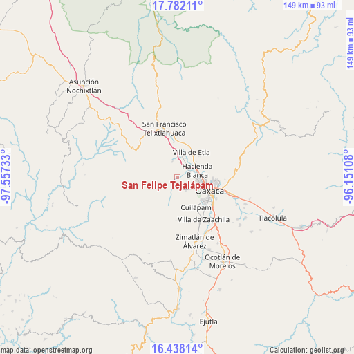
San Felipe Tejalápam GPS coordinates[2]
17° 6' 40.824" North, 96° 51' 15.12" West
| Map corner | latitude | longitude |
|---|---|---|
| Upper-left | 17.78211°, | -97.55733° |
| Center: | 17.11134°, | -96.8542° |
| Lower-right: | 16.43814°, | -96.15108° |
| Map W x H: | 149.4×149.4 km | = 92.8×92.8mi |
| max Lat: | 32.7° ⇑87.6% North |
| San Felipe Tejalápam: | 17.11134° |
| min Lat: | ⇓12.4% South 14.53588° |
| min Long | San Felipe Teja | max Long |
| -117.105° | -96.8542° | -86.73105° |
| W 76.6%⇐ | ⇒23.4% E |
Elevation
Elevation of San Felipe Tejalápam is 1654 m = 5427 ft, and this is 400.3 m = 1313 ft above average elevation for this country.
| Max E: |
3497 m = 11473 ft | 43.1% |
| San Felipe Tejalápam | 1654 m 5427 ft | |
| Avg. | 1253.7 m = 4113 ft | |
Min E: |
-1 m = -3 ft | 56.9% |
See also: Mexico elevation on elevation.city.
Geographical zone
San Felipe Tejalápam is located in North Torrid zone (between Equator and Tropic of Cancer). Distance of this Northern Tropic circle is 703.3 km =437 mi to North.| Distance of | km | miles | from San Felipe Tejalápam |
|---|---|---|---|
| North Pole | 8104.5 | 5035.9 | to North |
| Arctic Circle | 5498.6 | 3416.7 | to North |
| Tropic Cancer | 703.3 | 437 | to North |
| Equator | 1902.6 | 1182.2 | to South |


Nearby cities:
15 places around San Felipe Tejalápam: (largest is in red/bold)
• Fraccionamiento Real Santa María
6.6 km =4.1 mi,  83°
83°
• Fraccionamiento Riberas de San Jerónimo
8.2 km =5.1 mi,  89°
89°
• Guadalupe Etla
8.3 km =5.2 mi,  34°
34°
• Guadalupe Hidalgo
6.2 km =3.9 mi,  47°
47°
• Hacienda Blanca
8.9 km =5.5 mi,  69°
69°
• Jalapa del Valle
5.5 km =3.4 mi,  208°
208°
• Loma Bonita (Paraje Jagüey)
8.7 km =5.4 mi,  126°
126°
• Matadamas
6.7 km =4.2 mi,  36°
36°
• San Andrés Ixtlahuaca
5.4 km =3.4 mi,  146°
146°
• San Andrés Zautla
8.5 km =5.3 mi,  352°
352°
• San Lorenzo Cacaotepec
5.8 km =3.6 mi, 71°
• San Pedro Ixtlahuaca
6.5 km =4 mi,  144°
144°
• Santa María Atzompa
8.3 km =5.2 mi,  97°
97°
• Santiago Etla
8.2 km =5.1 mi,  56°
56°
• Santo Tomás Mazaltepec
7.1 km =4.4 mi,  343°
343°
Sources, notices
• [Note1] Compared only with cities in Mexico existing in our database
• [Src1] Map data: © OpenStreetMap contributors (CC-BY-SA)
• [Src2] Other city data from geonames.org with taken over terms of usage.
• [Src3] Geographical zone / Annual Mean Temperature by Robert A. Rohde @ Wikipedia
