San Isidro el Tanque geodata
San Isidro el Tanque (Hidalgo) is a populated place; located in Mexico in America/Mexico_City (GMT-6) time zone. With population of 590 people, there are 14554 cities with bigger population in this country. Compared to other cities in Mexico, 60.8% of cities are located further ↓South; 54% of cities are located further →East and 75.9% of cities have lower elevation than San Isidro el Tanque. Note1
Current local time in San Isidro el Tanque:
06:50 AM, WednesdayDifference from your time zone: hours


San Isidro el Tanque GPS coordinates[2]
20° 10' 30" North, 99° 17' 12.984" West
| Map corner | latitude | longitude |
|---|---|---|
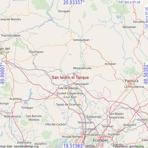
| Upper-left | 20.83357°, | -99.99007° |
| Center: | 20.175°, | -99.28694° |
| Lower-right: | 19.51363°, | -98.58382° |
| Map W x H: | 146.8×146.8 km | = 91.2×91.2mi |
| max Lat: | 32.7° ⇑39.2% North |
| San Isidro el Tanque: | 20.175° |
| min Lat: | ⇓60.8% South 14.53588° |
| min Long | San Isidro el T | max Long |
| -117.105° | -99.28694° | -86.73105° |
| W 46%⇐ | ⇒54% E |
Elevation
Elevation of San Isidro el Tanque is 2047 m = 6716 ft, and this is 793.3 m = 2603 ft above average elevation for this country.
| Max E: |
3497 m = 11473 ft | 24.1% |
| San Isidro el Tanque | 2047 m 6716 ft | |
| Avg. | 1253.7 m = 4113 ft | |
Min E: |
-1 m = -3 ft | 75.9% |
See also: Mexico elevation on elevation.city.
Geographical zone
San Isidro el Tanque is located in North Torrid zone (between Equator and Tropic of Cancer). Distance of this Northern Tropic circle is 362.7 km =225.4 mi to North.| Distance of | km | miles | from San Isidro el Tanque |
|---|---|---|---|
| North Pole | 7763.8 | 4824.2 | to North |
| Arctic Circle | 5157.9 | 3205 | to North |
| Tropic Cancer | 362.7 | 225.4 | to North |
| Equator | 2243.2 | 1393.9 | to South |


Nearby cities:
15 places around San Isidro el Tanque: (largest is in red/bold)
• Atengo
4.2 km =2.6 mi,  270°
270°
• Colonia Lázaro Cárdenas
5.9 km =3.7 mi,  125°
125°
• Colonia San Juan
1.8 km =1.1 mi,  14°
14°
• Huitel
1.2 km =0.7 mi,  135°
135°
• La Cruz
4.7 km =2.9 mi,  88°
88°
• La Loma
2.5 km =1.6 mi,  83°
83°
• La Palma
5.6 km =3.5 mi,  35°
35°
• Mangas
4.3 km =2.7 mi,  72°
72°
• Panuaya
2.8 km =1.7 mi, 37°
• Presas
4 km =2.5 mi,  115°
115°
• San Gabriel
5 km =3.1 mi, 265°
• San Juan Achichilco
2.9 km =1.8 mi,  278°
278°
• Santiago Acayutlán
2.6 km =1.6 mi,  340°
340°
• Tenango
5.8 km =3.6 mi,  356°
356°
• Tezontepec de Aldama
2.2 km =1.4 mi, 37°
Sources, notices
• [Note1] Compared only with cities in Mexico existing in our database
• [Src1] Map data: © OpenStreetMap contributors (CC-BY-SA)
• [Src2] Other city data from geonames.org with taken over terms of usage.
• [Src3] Geographical zone / Annual Mean Temperature by Robert A. Rohde @ Wikipedia
