San Agustín el Alto (La Araña) geodata
San Agustín el Alto (La Araña) (Guanajuato) is a populated place; located in Mexico in America/Mexico_City (GMT-6) time zone. With population of 586 people, there are 14641 cities with bigger population in this country. Compared to other cities in Mexico, 69.9% of cities are located further ↓South; 76.2% of cities are located further →East and 59.2% of cities have lower elevation than San Agustín el Alto (La Araña). Note1
Current local time in San Agustín el Alto (La Araña):
08:06 AM, WednesdayDifference from your time zone: hours


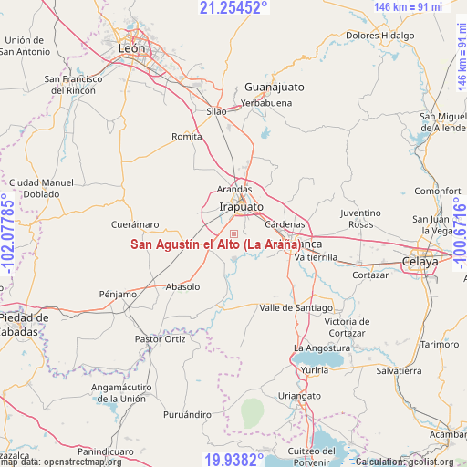
San Agustín el Alto (La Araña) GPS coordinates[2]
20° 35' 52.008" North, 101° 22' 28.992" West
| Map corner | latitude | longitude |
|---|---|---|
| Upper-left | 21.25452°, | -102.07785° |
| Center: | 20.59778°, | -101.37472° |
| Lower-right: | 19.9382°, | -100.6716° |
| Map W x H: | 146.4×146.4 km | = 91×91mi |
| max Lat: | 32.7° ⇑30.1% North |
| San Agustín el Alto (La Araña): | 20.59778° |
| min Lat: | ⇓69.9% South 14.53588° |
| min Long | San Agustín el | max Long |
| -117.105° | -101.37472° | -86.73105° |
| W 23.8%⇐ | ⇒76.2% E |
Elevation
Elevation of San Agustín el Alto (La Araña) is 1714 m = 5623 ft, and this is 460.3 m = 1510 ft above average elevation for this country.
| Max E: |
3497 m = 11473 ft | 40.8% |
| San Agustín el Alto (La Araña) | 1714 m 5623 ft | |
| Avg. | 1253.7 m = 4113 ft | |
Min E: |
-1 m = -3 ft | 59.2% |
See also: Mexico elevation on elevation.city.
Geographical zone
San Agustín el Alto (La Araña) is located in North Torrid zone (between Equator and Tropic of Cancer). Distance of this Northern Tropic circle is 315.7 km =196.2 mi to North.| Distance of | km | miles | from San Agustín el Alto (La Araña) |
|---|---|---|---|
| North Pole | 7716.8 | 4795 | to North |
| Arctic Circle | 5110.9 | 3175.8 | to North |
| Tropic Cancer | 315.7 | 196.2 | to North |
| Equator | 2290.3 | 1423.1 | to South |


Nearby cities:
15 places around San Agustín el Alto (La Araña): (largest is in red/bold)
• Colonia Morelos de Guadalupe de Rivera
7.7 km =4.8 mi,  268°
268°
• El Carmen
4.7 km =2.9 mi,  2°
2°
• Fraccionamiento las Liebres
5.9 km =3.7 mi,  338°
338°
• La Candelaria (El Rodete)
6.5 km =4 mi, 344°
• La Soledad
4.4 km =2.7 mi,  284°
284°
• La Soledad
7.8 km =4.8 mi,  135°
135°
• La Zahúrda
4.5 km =2.8 mi,  12°
12°
• Las Huertas Tercera Sección
6.4 km =4 mi, 342°
• Providencia de Pérez
5.4 km =3.4 mi, 279°
• Pueblo Nuevo
8.1 km =5 mi,  177°
177°
• Rancho Nuevo de Dolores (El Cuero)
5.3 km =3.3 mi,  308°
308°
• San José de Bernalejo (El Guayabo)
5.5 km =3.4 mi,  329°
329°
• San Roque
3.4 km =2.1 mi,  86°
86°
• Tomelopitos
0.7 km =0.4 mi,  118°
118°
• Villa de Guadalupe
3.6 km =2.2 mi,  191°
191°
Sources, notices
• [Note1] Compared only with cities in Mexico existing in our database
• [Src1] Map data: © OpenStreetMap contributors (CC-BY-SA)
• [Src2] Other city data from geonames.org with taken over terms of usage.
• [Src3] Geographical zone / Annual Mean Temperature by Robert A. Rohde @ Wikipedia
