Villa de Guadalupe geodata
Villa de Guadalupe (Guanajuato) is a populated place; located in Mexico in America/Mexico_City (GMT-6) time zone. With population of 586 people, there are 14641 cities with bigger population in this country. Compared to other cities in Mexico, 69.3% of cities are located further ↓South; 76.3% of cities are located further →East and 59.6% of cities have lower elevation than Villa de Guadalupe. Note1


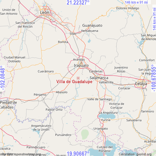
Villa de Guadalupe GPS coordinates[2]
20° 33' 59.004" North, 101° 22' 54.012" West
| Map corner | latitude | longitude |
|---|---|---|
| Upper-left | 21.22327°, | -102.0848° |
| Center: | 20.56639°, | -101.38167° |
| Lower-right: | 19.90667°, | -100.67855° |
| Map W x H: | 146.4×146.4 km | = 91×91mi |
| max Lat: | 32.7° ⇑30.7% North |
| Villa de Guadalupe: | 20.56639° |
| min Lat: | ⇓69.3% South 14.53588° |
| min Long | Villa de Guadal | max Long |
| -117.105° | -101.38167° | -86.73105° |
| W 23.7%⇐ | ⇒76.3% E |
Elevation
Elevation of Villa de Guadalupe is 1720 m = 5643 ft, and this is 466.3 m = 1530 ft above average elevation for this country.
| Max E: |
3497 m = 11473 ft | 40.4% |
| Villa de Guadalupe | 1720 m 5643 ft | |
| Avg. | 1253.7 m = 4113 ft | |
Min E: |
-1 m = -3 ft | 59.6% |
See also: Mexico elevation on elevation.city.
Geographical zone
Villa de Guadalupe is located in North Torrid zone (between Equator and Tropic of Cancer). Distance of this Northern Tropic circle is 319.2 km =198.3 mi to North.| Distance of | km | miles | from Villa de Guadalupe |
|---|---|---|---|
| North Pole | 7720.3 | 4797.2 | to North |
| Arctic Circle | 5114.4 | 3177.9 | to North |
| Tropic Cancer | 319.2 | 198.3 | to North |
| Equator | 2286.8 | 1421 | to South |


Nearby cities:
15 places around Villa de Guadalupe: (largest is in red/bold)
• Colonia Morelos de Guadalupe de Rivera
7.7 km =4.8 mi,  295°
295°
• El Carmen
8.2 km =5.1 mi,  6°
6°
• La Soledad
5.8 km =3.6 mi,  322°
322°
• La Soledad
6.5 km =4 mi,  109°
109°
• La Zahúrda
8.1 km =5 mi, 12°
• Providencia de Pérez
6.3 km =3.9 mi,  313°
313°
• Pueblo Nuevo
4.7 km =2.9 mi,  167°
167°
• Rancho Nuevo de Dolores (El Cuero)
7.6 km =4.7 mi,  333°
333°
• San Agustín el Alto (La Araña)
3.6 km =2.2 mi, 11°
• San Guillermo
7.3 km =4.5 mi, 165°
• San Ignacio de Rivera (Ojo de Agua)
8.3 km =5.2 mi,  264°
264°
• San Luis del Jánamo (El Morado)
7.9 km =4.9 mi,  288°
288°
• San Miguel del Brete
6.2 km =3.9 mi,  254°
254°
• San Roque
5.6 km =3.5 mi,  48°
48°
• Tomelopitos
3.4 km =2.1 mi,  23°
23°
Sources, notices
• [Note1] Compared only with cities in Mexico existing in our database
• [Src1] Map data: © OpenStreetMap contributors (CC-BY-SA)
• [Src2] Other city data from geonames.org with taken over terms of usage.
• [Src3] Geographical zone / Annual Mean Temperature by Robert A. Rohde @ Wikipedia
