Pueblo Nuevo geodata
Pueblo Nuevo (Guanajuato) is a seat of a second-order administrative division; located in Mexico in America/Mexico_City (GMT-6) time zone. With population of 3,741 people, there are 2455 cities with bigger population in this country. Compared to other cities in Mexico, 68.3% of cities are located further ↓South; 76.2% of cities are located further →East and 59.1% of cities have lower elevation than Pueblo Nuevo. Note1


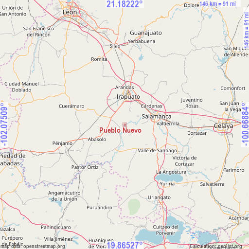
Pueblo Nuevo GPS coordinates[2]
20° 31' 30.576" North, 101° 22' 19.056" West
| Map corner | latitude | longitude |
|---|---|---|
| Upper-left | 21.18222°, | -102.07509° |
| Center: | 20.52516°, | -101.37196° |
| Lower-right: | 19.86527°, | -100.66884° |
| Map W x H: | 146.4×146.4 km | = 91×91mi |
| max Lat: | 32.7° ⇑31.7% North |
| Pueblo Nuevo: | 20.52516° |
| min Lat: | ⇓68.3% South 14.53588° |
| min Long | Pueblo Nuevo | max Long |
| -117.105° | -101.37196° | -86.73105° |
| W 23.8%⇐ | ⇒76.2% E |
Elevation
Elevation of Pueblo Nuevo is 1710 m = 5610 ft, and this is 456.3 m = 1497 ft above average elevation for this country.
| Max E: |
3497 m = 11473 ft | 40.9% |
| Pueblo Nuevo | 1710 m 5610 ft | |
| Avg. | 1253.7 m = 4113 ft | |
Min E: |
-1 m = -3 ft | 59.1% |
See also: Mexico elevation on elevation.city.
Geographical zone
Pueblo Nuevo is located in North Torrid zone (between Equator and Tropic of Cancer). Distance of this Northern Tropic circle is 323.7 km =201.1 mi to North.| Distance of | km | miles | from Pueblo Nuevo |
|---|---|---|---|
| North Pole | 7724.9 | 4800 | to North |
| Arctic Circle | 5119 | 3180.8 | to North |
| Tropic Cancer | 323.7 | 201.1 | to North |
| Equator | 2282.2 | 1418.1 | to South |


Nearby cities:
15 places around Pueblo Nuevo: (largest is in red/bold)
• Cerro Prieto
6.1 km =3.8 mi,  98°
98°
• El Tambor
7.9 km =4.9 mi,  112°
112°
• La Capilla
8.2 km =5.1 mi,  64°
64°
• La Soledad
5.7 km =3.5 mi, 64°
• Noria de Mosqueda
5.9 km =3.7 mi,  151°
151°
• Peralta
6.9 km =4.3 mi,  213°
213°
• Rincón de Alonso Sánchez
5.7 km =3.5 mi,  197°
197°
• San Agustín el Alto (La Araña)
8.1 km =5 mi,  357°
357°
• San Guillermo
2.6 km =1.6 mi,  161°
161°
• San Miguel del Brete
7.6 km =4.7 mi,  292°
292°
• San Roque
8.9 km =5.5 mi,  20°
20°
• Santa Bárbara
6 km =3.7 mi, 156°
• Tomelopitos
7.7 km =4.8 mi,  2°
2°
• Villa de Guadalupe
4.7 km =2.9 mi,  347°
347°
• Zapote de Peralta
8.6 km =5.3 mi, 196°
Sources, notices
• [Note1] Compared only with cities in Mexico existing in our database
• [Src1] Map data: © OpenStreetMap contributors (CC-BY-SA)
• [Src2] Other city data from geonames.org with taken over terms of usage.
• [Src3] Geographical zone / Annual Mean Temperature by Robert A. Rohde @ Wikipedia
