La Cumbre del Manzano geodata
La Cumbre del Manzano (Puebla) is a populated place; located in Mexico in America/Mexico_City (GMT-6) time zone. With population of 578 people, there are 14828 cities with bigger population in this country. Compared to other cities in Mexico, 62.5% of cities are located further ↓South; 61% of cities are located further ←West and 80.5% of cities have lower elevation than La Cumbre del Manzano. Note1


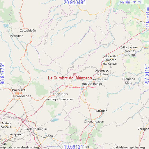
La Cumbre del Manzano GPS coordinates[2]
20° 15' 8.1" North, 98° 12' 52.632" West
| Map corner | latitude | longitude |
|---|---|---|
| Upper-left | 20.91049°, | -98.91775° |
| Center: | 20.25225°, | -98.21462° |
| Lower-right: | 19.59121°, | -97.5115° |
| Map W x H: | 146.7×146.7 km | = 91.2×91.2mi |
| max Lat: | 32.7° ⇑37.5% North |
| La Cumbre del Manzano: | 20.25225° |
| min Lat: | ⇓62.5% South 14.53588° |
| min Long | La Cumbre del M | max Long |
| -117.105° | -98.21462° | -86.73105° |
| W 61%⇐ | ⇒39% E |
Elevation
Elevation of La Cumbre del Manzano is 2152 m = 7060 ft, and this is 898.3 m = 2947 ft above average elevation for this country.
| Max E: |
3497 m = 11473 ft | 19.5% |
| La Cumbre del Manzano | 2152 m 7060 ft | |
| Avg. | 1253.7 m = 4113 ft | |
Min E: |
-1 m = -3 ft | 80.5% |
See also: Mexico elevation on elevation.city.
Geographical zone
La Cumbre del Manzano is located in North Torrid zone (between Equator and Tropic of Cancer). Distance of this Northern Tropic circle is 354.1 km =220 mi to North.| Distance of | km | miles | from La Cumbre del Manzano |
|---|---|---|---|
| North Pole | 7755.2 | 4818.9 | to North |
| Arctic Circle | 5149.3 | 3199.6 | to North |
| Tropic Cancer | 354.1 | 220 | to North |
| Equator | 2251.8 | 1399.2 | to South |


Nearby cities:
15 places around La Cumbre del Manzano: (largest is in red/bold)
• Amapoloa
1.3 km =0.8 mi,  226°
226°
• Chila de Juárez
3.3 km =2.1 mi,  9°
9°
• Honey
1.5 km =0.9 mi,  171°
171°
• La Cruz de Tenango
7 km =4.3 mi,  298°
298°
• La Magdalena
6.4 km =4 mi,  274°
274°
• La Victoria
8.2 km =5.1 mi, 271°
• Pahuatlán de Valle
7.3 km =4.5 mi,  66°
66°
• San Mateo
8.4 km =5.2 mi,  203°
203°
• San Miguel del Resgate
4.9 km =3 mi,  123°
123°
• San Nicolás
8.3 km =5.2 mi,  19°
19°
• San Pablito
7.7 km =4.8 mi,  45°
45°
• Santa Ana Tzacuala
6.1 km =3.8 mi, 169°
• Santa Mónica
6.3 km =3.9 mi,  356°
356°
• Tonalixco
4.8 km =3 mi,  241°
241°
• Zacacuautla
4.4 km =2.7 mi, 199°
Sources, notices
• [Note1] Compared only with cities in Mexico existing in our database
• [Src1] Map data: © OpenStreetMap contributors (CC-BY-SA)
• [Src2] Other city data from geonames.org with taken over terms of usage.
• [Src3] Geographical zone / Annual Mean Temperature by Robert A. Rohde @ Wikipedia
