Pahuatlán de Valle geodata
Pahuatlán de Valle (Puebla) is a seat of a second-order administrative division; located in Mexico in America/Mexico_City (GMT-6) time zone. With population of 3,490 people, there are 2620 cities with bigger population in this country. Compared to other cities in Mexico, 63.1% of cities are located further ↓South; 61.9% of cities are located further ←West and 58.7% of cities have higher elevation than Pahuatlán de Valle. Note1


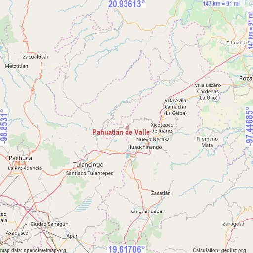
Pahuatlán de Valle GPS coordinates[2]
20° 16' 40.8" North, 98° 8' 59.892" West
| Map corner | latitude | longitude |
|---|---|---|
| Upper-left | 20.93613°, | -98.8531° |
| Center: | 20.278°, | -98.14997° |
| Lower-right: | 19.61706°, | -97.44685° |
| Map W x H: | 146.7×146.7 km | = 91.2×91.2mi |
| max Lat: | 32.7° ⇑36.9% North |
| Pahuatlán de Valle: | 20.278° |
| min Lat: | ⇓63.1% South 14.53588° |
| min Long | Pahuatlán de V | max Long |
| -117.105° | -98.14997° | -86.73105° |
| W 61.9%⇐ | ⇒38.1% E |
Elevation
Elevation of Pahuatlán de Valle is 1067 m = 3501 ft, and this is 186.7 m = 613 ft below average elevation for this country.
| Max E: |
3497 m = 11473 ft | 58.7% |
| Avg. | 1253.7 m = 4113 ft | |
| Pahuatlán de Valle | 1067 m = 3501 ft | |
Min E: |
-1 m = -3 ft | 41.3% |
See also: Mexico elevation on elevation.city.
Geographical zone
Pahuatlán de Valle is located in North Torrid zone (between Equator and Tropic of Cancer). Distance of this Northern Tropic circle is 351.2 km =218.2 mi to North.| Distance of | km | miles | from Pahuatlán de Valle |
|---|---|---|---|
| North Pole | 7752.4 | 4817.1 | to North |
| Arctic Circle | 5146.5 | 3197.9 | to North |
| Tropic Cancer | 351.2 | 218.2 | to North |
| Equator | 2254.7 | 1401 | to South |


Nearby cities:
15 places around Pahuatlán de Valle: (largest is in red/bold)
• Atla
2.7 km =1.7 mi,  96°
96°
• Atlantongo
3.6 km =2.2 mi,  114°
114°
• Chila de Juárez
6.2 km =3.9 mi,  273°
273°
• Cuauneutla de la Paz
6.4 km =4 mi,  50°
50°
• Icxotitla
6.5 km =4 mi,  127°
127°
• Naupan
6.7 km =4.2 mi,  140°
140°
• Paciotla
2.2 km =1.4 mi,  21°
21°
• San Miguel del Resgate
6.1 km =3.8 mi,  205°
205°
• San Nicolás
6.3 km =3.9 mi,  321°
321°
• San Pablito
2.8 km =1.7 mi,  333°
333°
• Tlalcruz de Libres
4.9 km =3 mi, 53°
• Tlaxpanaloya
6.6 km =4.1 mi,  151°
151°
• Xochimilco
3.4 km =2.1 mi,  352°
352°
• Xolotla
2.8 km =1.7 mi, 141°
• Zoyatla de Guerrero
3.4 km =2.1 mi,  39°
39°
Sources, notices
• [Note1] Compared only with cities in Mexico existing in our database
• [Src1] Map data: © OpenStreetMap contributors (CC-BY-SA)
• [Src2] Other city data from geonames.org with taken over terms of usage.
• [Src3] Geographical zone / Annual Mean Temperature by Robert A. Rohde @ Wikipedia
