La Soledad geodata
La Soledad (Chiapas) is a populated place; located in Mexico in America/Mexico_City (GMT-6) time zone. With population of 506 people, there are 16626 cities with bigger population in this country. Compared to other cities in Mexico, 93% of cities are located further ↑North; 91.7% of cities are located further ←West and 88% of cities have lower elevation than La Soledad. Note1


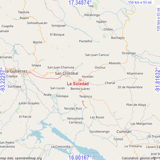
La Soledad GPS coordinates[2]
16° 40' 35.004" North, 92° 31' 9.984" West
| Map corner | latitude | longitude |
|---|---|---|
| Upper-left | 17.34874°, | -93.22257° |
| Center: | 16.67639°, | -92.51944° |
| Lower-right: | 16.00167°, | -91.81632° |
| Map W x H: | 149.8×149.8 km | = 93.1×93.1mi |
| max Lat: | 32.7° ⇑93% North |
| La Soledad: | 16.67639° |
| min Lat: | ⇓7% South 14.53588° |
| min Long | La Soledad | max Long |
| -117.105° | -92.51944° | -86.73105° |
| W 91.7%⇐ | ⇒8.3% E |
Elevation
Elevation of La Soledad is 2341 m = 7680 ft, and this is 1087.3 m = 3567 ft above average elevation for this country.
| Max E: |
3497 m = 11473 ft | 12% |
| La Soledad | 2341 m 7680 ft | |
| Avg. | 1253.7 m = 4113 ft | |
Min E: |
-1 m = -3 ft | 88% |
See also: Mexico elevation on elevation.city.
Geographical zone
La Soledad is located in North Torrid zone (between Equator and Tropic of Cancer). Distance of this Northern Tropic circle is 751.7 km =467.1 mi to North.| Distance of | km | miles | from La Soledad |
|---|---|---|---|
| North Pole | 8152.8 | 5065.9 | to North |
| Arctic Circle | 5546.9 | 3446.7 | to North |
| Tropic Cancer | 751.7 | 467.1 | to North |
| Equator | 1854.2 | 1152.1 | to South |


Nearby cities:
15 places around La Soledad: (largest is in red/bold)
• Betania
7.8 km =4.8 mi,  181°
181°
• Corazón de María
3 km =1.9 mi,  328°
328°
• Dolores
8 km =5 mi, 176°
• El Aguaje (La Albarada)
7.6 km =4.7 mi,  279°
279°
• El Escalón
3.3 km =2.1 mi,  2°
2°
• Eshpuilho
6.1 km =3.8 mi,  51°
51°
• Galilea
7.5 km =4.7 mi,  172°
172°
• Huixtán
8 km =5 mi,  61°
61°
• La Candelaria
7.4 km =4.6 mi,  358°
358°
• La Sierra
4.8 km =3 mi, 328°
• Lázaro Cárdenas (Chilil)
3.2 km =2 mi,  90°
90°
• Mitzitón
4.2 km =2.6 mi,  217°
217°
• Nuevo Zinacantán
8 km =5 mi, 181°
• Oquem
6.9 km =4.3 mi,  39°
39°
• San Pedro la Tejería
5.9 km =3.7 mi,  9°
9°
Sources, notices
• [Note1] Compared only with cities in Mexico existing in our database
• [Src1] Map data: © OpenStreetMap contributors (CC-BY-SA)
• [Src2] Other city data from geonames.org with taken over terms of usage.
• [Src3] Geographical zone / Annual Mean Temperature by Robert A. Rohde @ Wikipedia
