Lagunillas geodata
Lagunillas (Puebla) is a populated place; located in Mexico in America/Mexico_City (GMT-6) time zone. With population of 545 people, there are 15598 cities with bigger population in this country. Compared to other cities in Mexico, 61.9% of cities are located further ↓South; 64.3% of cities are located further ←West and 54.9% of cities have higher elevation than Lagunillas. Note1


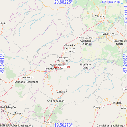
Lagunillas GPS coordinates[2]
20° 13' 26.004" North, 97° 56' 42" West
| Map corner | latitude | longitude |
|---|---|---|
| Upper-left | 20.88225°, | -98.64813° |
| Center: | 20.22389°, | -97.945° |
| Lower-right: | 19.56273°, | -97.24188° |
| Map W x H: | 146.7×146.7 km | = 91.2×91.2mi |
| max Lat: | 32.7° ⇑38.1% North |
| Lagunillas: | 20.22389° |
| min Lat: | ⇓61.9% South 14.53588° |
| min Long | Lagunillas | max Long |
| -117.105° | -97.945° | -86.73105° |
| W 64.3%⇐ | ⇒35.7% E |
Elevation
Elevation of Lagunillas is 1202 m = 3944 ft, and this is 51.7 m = 170 ft below average elevation for this country.
| Max E: |
3497 m = 11473 ft | 54.9% |
| Avg. | 1253.7 m = 4113 ft | |
| Lagunillas | 1202 m = 3944 ft | |
Min E: |
-1 m = -3 ft | 45.1% |
See also: Mexico elevation on elevation.city.
Geographical zone
Lagunillas is located in North Torrid zone (between Equator and Tropic of Cancer). Distance of this Northern Tropic circle is 357.2 km =222 mi to North.| Distance of | km | miles | from Lagunillas |
|---|---|---|---|
| North Pole | 7758.4 | 4820.8 | to North |
| Arctic Circle | 5152.5 | 3201.6 | to North |
| Tropic Cancer | 357.2 | 222 | to North |
| Equator | 2248.7 | 1397.3 | to South |


Nearby cities:
15 places around Lagunillas: (largest is in red/bold)
• Duraznotla
5.4 km =3.4 mi,  321°
321°
• Las Colonias de Hidalgo
4.5 km =2.8 mi,  226°
226°
• Lomas Verdes
4.2 km =2.6 mi,  354°
354°
• Los Pinos
1.2 km =0.7 mi,  84°
84°
• Mazacoatlán
2.5 km =1.6 mi,  87°
87°
• Morelos
3.9 km =2.4 mi,  4°
4°
• Necaxaltépetl
5.5 km =3.4 mi,  283°
283°
• Ocomantla
5.8 km =3.6 mi,  66°
66°
• San Antonio Ocopetlatlán
2.6 km =1.6 mi,  357°
357°
• San Isidro
3.4 km =2.1 mi,  329°
329°
• San Pedro Itztla
5.8 km =3.6 mi,  10°
10°
• Telolotla
3.7 km =2.3 mi,  109°
109°
• Tenango de las Flores
4.9 km =3 mi,  245°
245°
• Tierra Negra
2.5 km =1.6 mi, 330°
• Tzitzicazapa
2.4 km =1.5 mi,  161°
161°
Sources, notices
• [Note1] Compared only with cities in Mexico existing in our database
• [Src1] Map data: © OpenStreetMap contributors (CC-BY-SA)
• [Src2] Other city data from geonames.org with taken over terms of usage.
• [Src3] Geographical zone / Annual Mean Temperature by Robert A. Rohde @ Wikipedia
