Telolotla geodata
Telolotla (Puebla) is a populated place; located in Mexico in America/Mexico_City (GMT-6) time zone. With population of 928 people, there are 9400 cities with bigger population in this country. Compared to other cities in Mexico, 61.6% of cities are located further ↓South; 64.7% of cities are located further ←West and 62.6% of cities have higher elevation than Telolotla. Note1


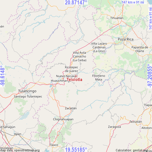
Telolotla GPS coordinates[2]
20° 12' 47.016" North, 97° 54' 42.012" West
| Map corner | latitude | longitude |
|---|---|---|
| Upper-left | 20.87147°, | -98.6148° |
| Center: | 20.21306°, | -97.91167° |
| Lower-right: | 19.55185°, | -97.20855° |
| Map W x H: | 146.7×146.7 km | = 91.2×91.2mi |
| max Lat: | 32.7° ⇑38.4% North |
| Telolotla: | 20.21306° |
| min Lat: | ⇓61.6% South 14.53588° |
| min Long | Telolotla | max Long |
| -117.105° | -97.91167° | -86.73105° |
| W 64.7%⇐ | ⇒35.3% E |
Elevation
Elevation of Telolotla is 847 m = 2779 ft, and this is 406.7 m = 1334 ft below average elevation for this country.
| Max E: |
3497 m = 11473 ft | 62.6% |
| Avg. | 1253.7 m = 4113 ft | |
| Telolotla | 847 m = 2779 ft | |
Min E: |
-1 m = -3 ft | 37.4% |
See also: Mexico elevation on elevation.city.
Geographical zone
Telolotla is located in North Torrid zone (between Equator and Tropic of Cancer). Distance of this Northern Tropic circle is 358.4 km =222.7 mi to North.| Distance of | km | miles | from Telolotla |
|---|---|---|---|
| North Pole | 7759.6 | 4821.6 | to North |
| Arctic Circle | 5153.7 | 3202.4 | to North |
| Tropic Cancer | 358.4 | 222.7 | to North |
| Equator | 2247.5 | 1396.5 | to South |


Nearby cities:
15 places around Telolotla: (largest is in red/bold)
• Ahuaxintitla
4.8 km =3 mi,  20°
20°
• Atequexquitla
6.1 km =3.8 mi, 20°
• Lagunillas
3.7 km =2.3 mi,  289°
289°
• Los Pinos
2.6 km =1.6 mi,  300°
300°
• Mazacoatlán
1.7 km =1.1 mi,  322°
322°
• Morelos
6 km =3.7 mi,  327°
327°
• Ocomantla
3.9 km =2.4 mi,  27°
27°
• Quamila
5.2 km =3.2 mi,  187°
187°
• San Antonio Ocopetlatlán
5.2 km =3.2 mi, 316°
• Tecpatlán
5.5 km =3.4 mi,  57°
57°
• Tierra Negra
5.8 km =3.6 mi,  305°
305°
• Tlatlapanala
4.8 km =3 mi,  202°
202°
• Tzitzicazapa
2.9 km =1.8 mi,  248°
248°
• Xochinanacatlán
2.5 km =1.6 mi,  144°
144°
• Zihuateutla
4.9 km =3 mi, 30°
Sources, notices
• [Note1] Compared only with cities in Mexico existing in our database
• [Src1] Map data: © OpenStreetMap contributors (CC-BY-SA)
• [Src2] Other city data from geonames.org with taken over terms of usage.
• [Src3] Geographical zone / Annual Mean Temperature by Robert A. Rohde @ Wikipedia
