Duraznotla geodata
Duraznotla (Puebla) is a populated place; located in Mexico in America/Mexico_City (GMT-6) time zone. With population of 561 people, there are 15205 cities with bigger population in this country. Compared to other cities in Mexico, 62.7% of cities are located further ↓South; 63.9% of cities are located further ←West and 55.4% of cities have higher elevation than Duraznotla. Note1


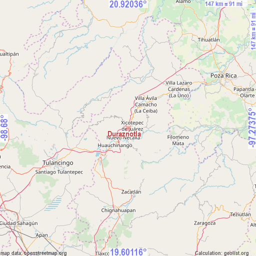
Duraznotla GPS coordinates[2]
20° 15' 43.776" North, 97° 58' 36.732" West
| Map corner | latitude | longitude |
|---|---|---|
| Upper-left | 20.92036°, | -98.68° |
| Center: | 20.26216°, | -97.97687° |
| Lower-right: | 19.60116°, | -97.27375° |
| Map W x H: | 146.7×146.7 km | = 91.2×91.2mi |
| max Lat: | 32.7° ⇑37.3% North |
| Duraznotla: | 20.26216° |
| min Lat: | ⇓62.7% South 14.53588° |
| min Long | Duraznotla | max Long |
| -117.105° | -97.97687° | -86.73105° |
| W 63.9%⇐ | ⇒36.1% E |
Elevation
Elevation of Duraznotla is 1183 m = 3881 ft, and this is 70.7 m = 232 ft below average elevation for this country.
| Max E: |
3497 m = 11473 ft | 55.4% |
| Avg. | 1253.7 m = 4113 ft | |
| Duraznotla | 1183 m = 3881 ft | |
Min E: |
-1 m = -3 ft | 44.6% |
See also: Mexico elevation on elevation.city.
Geographical zone
Duraznotla is located in North Torrid zone (between Equator and Tropic of Cancer). Distance of this Northern Tropic circle is 353 km =219.3 mi to North.| Distance of | km | miles | from Duraznotla |
|---|---|---|---|
| North Pole | 7754.1 | 4818.2 | to North |
| Arctic Circle | 5148.2 | 3198.9 | to North |
| Tropic Cancer | 353 | 219.3 | to North |
| Equator | 2252.9 | 1399.9 | to South |


Nearby cities:
15 places around Duraznotla: (largest is in red/bold)
• Cuaxicala
5.8 km =3.6 mi,  243°
243°
• Lagunillas
5.4 km =3.4 mi,  141°
141°
• Lomas Verdes
2.9 km =1.8 mi,  90°
90°
• Los Pinos
6.1 km =3.8 mi,  132°
132°
• Morelos
3.7 km =2.3 mi,  96°
96°
• Necaxa
6.6 km =4.1 mi,  213°
213°
• Necaxaltépetl
3.6 km =2.2 mi, 213°
• Nuevo Necaxa
6.5 km =4 mi, 208°
• San Antonio Ocopetlatlán
3.6 km =2.2 mi,  117°
117°
• San Isidro
2.1 km =1.3 mi, 129°
• San Pedro Itztla
4.6 km =2.9 mi,  72°
72°
• Tenango de las Flores
6.4 km =4 mi,  190°
190°
• Tepetzintla de Galeana
5.2 km =3.2 mi,  292°
292°
• Tierra Negra
3 km =1.9 mi, 134°
• Xicotepec de Juárez
2.3 km =1.4 mi,  46°
46°
Sources, notices
• [Note1] Compared only with cities in Mexico existing in our database
• [Src1] Map data: © OpenStreetMap contributors (CC-BY-SA)
• [Src2] Other city data from geonames.org with taken over terms of usage.
• [Src3] Geographical zone / Annual Mean Temperature by Robert A. Rohde @ Wikipedia
