Zacualtipanito geodata
Zacualtipanito (Hidalgo) is a populated place; located in Mexico in America/Mexico_City (GMT-6) time zone. With population of 1,502 people, there are 5745 cities with bigger population in this country. Compared to other cities in Mexico, 78.6% of cities are located further ↓South; 53.6% of cities are located further ←West and 66.5% of cities have higher elevation than Zacualtipanito. Note1


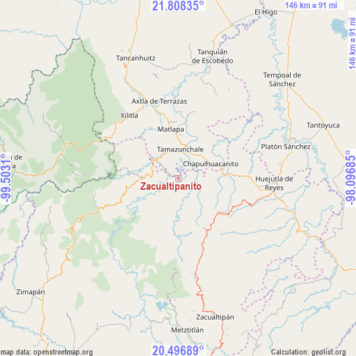
Zacualtipanito GPS coordinates[2]
21° 9' 14.652" North, 98° 47' 59.892" West
| Map corner | latitude | longitude |
|---|---|---|
| Upper-left | 21.80835°, | -99.5031° |
| Center: | 21.15407°, | -98.79997° |
| Lower-right: | 20.49689°, | -98.09685° |
| Map W x H: | 145.8×145.8 km | = 90.6×90.6mi |
| max Lat: | 32.7° ⇑21.4% North |
| Zacualtipanito: | 21.15407° |
| min Lat: | ⇓78.6% South 14.53588° |
| min Long | Zacualtipanito | max Long |
| -117.105° | -98.79997° | -86.73105° |
| W 53.6%⇐ | ⇒46.4% E |
Elevation
Elevation of Zacualtipanito is 611 m = 2005 ft, and this is 642.7 m = 2109 ft below average elevation for this country.
| Max E: |
3497 m = 11473 ft | 66.5% |
| Avg. | 1253.7 m = 4113 ft | |
| Zacualtipanito | 611 m = 2005 ft | |
Min E: |
-1 m = -3 ft | 33.5% |
See also: Mexico elevation on elevation.city.
Geographical zone
Zacualtipanito is located in North Torrid zone (between Equator and Tropic of Cancer). Distance of this Northern Tropic circle is 253.8 km =157.7 mi to North.| Distance of | km | miles | from Zacualtipanito |
|---|---|---|---|
| North Pole | 7654.9 | 4756.5 | to North |
| Arctic Circle | 5049.1 | 3137.4 | to North |
| Tropic Cancer | 253.8 | 157.7 | to North |
| Equator | 2352.1 | 1461.5 | to South |


Nearby cities:
15 places around Zacualtipanito: (largest is in red/bold)
• Acoyotla
4 km =2.5 mi,  143°
143°
• Axhumol
5.9 km =3.7 mi,  20°
20°
• Cahuazas
5.9 km =3.7 mi,  255°
255°
• Cahuazaz de Morelos (Rancho Alegre)
4 km =2.5 mi,  268°
268°
• Chahuatitla
5.9 km =3.7 mi,  228°
228°
• Chantasco
5.5 km =3.4 mi,  71°
71°
• Cuatolol
4.7 km =2.9 mi,  214°
214°
• El Carrizal
5.3 km =3.3 mi,  314°
314°
• Enramaditas
5.4 km =3.4 mi,  352°
352°
• Pemucho
5.7 km =3.5 mi,  326°
326°
• Tezapotla
2.5 km =1.6 mi, 329°
• Tixcuayuca
3.5 km =2.2 mi,  339°
339°
• Tlachiquilillacapa
4.7 km =2.9 mi,  296°
296°
• Tlalnepantla
5.6 km =3.5 mi, 301°
• Xalcuatla
5.1 km =3.2 mi,  49°
49°
Sources, notices
• [Note1] Compared only with cities in Mexico existing in our database
• [Src1] Map data: © OpenStreetMap contributors (CC-BY-SA)
• [Src2] Other city data from geonames.org with taken over terms of usage.
• [Src3] Geographical zone / Annual Mean Temperature by Robert A. Rohde @ Wikipedia
