San Nicolás Quialana geodata
San Nicolás Quialana (Oaxaca) is a populated place; located in Mexico in America/Mexico_City (GMT-6) time zone. With population of 1,042 people, there are 8364 cities with bigger population in this country. Compared to other cities in Mexico, 91.1% of cities are located further ↑North; 77.5% of cities are located further ←West and 51.1% of cities have lower elevation than San Nicolás Quialana. Note1


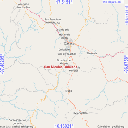
San Nicolás Quialana GPS coordinates[2]
16° 50' 36.06" North, 96° 46' 44.112" West
| Map corner | latitude | longitude |
|---|---|---|
| Upper-left | 17.5151°, | -97.48205° |
| Center: | 16.84335°, | -96.77892° |
| Lower-right: | 16.16921°, | -96.0758° |
| Map W x H: | 149.6×149.7 km | = 93×93mi |
| max Lat: | 32.7° ⇑91.1% North |
| San Nicolás Quialana: | 16.84335° |
| min Lat: | ⇓8.9% South 14.53588° |
| min Long | San Nicolás Qu | max Long |
| -117.105° | -96.77892° | -86.73105° |
| W 77.5%⇐ | ⇒22.5% E |
Elevation
Elevation of San Nicolás Quialana is 1488 m = 4882 ft, and this is 234.3 m = 769 ft above average elevation for this country.
| Max E: |
3497 m = 11473 ft | 48.9% |
| San Nicolás Quialana | 1488 m 4882 ft | |
| Avg. | 1253.7 m = 4113 ft | |
Min E: |
-1 m = -3 ft | 51.1% |
See also: Mexico elevation on elevation.city.
Geographical zone
San Nicolás Quialana is located in North Torrid zone (between Equator and Tropic of Cancer). Distance of this Northern Tropic circle is 733.1 km =455.5 mi to North.| Distance of | km | miles | from San Nicolás Quialana |
|---|---|---|---|
| North Pole | 8134.3 | 5054.4 | to North |
| Arctic Circle | 5528.4 | 3435.2 | to North |
| Tropic Cancer | 733.1 | 455.5 | to North |
| Equator | 1872.8 | 1163.7 | to South |


Nearby cities:
15 places around San Nicolás Quialana: (largest is in red/bold)
• Barrio la Guadalupe
8.4 km =5.2 mi,  359°
359°
• Ciénega de Zimatlán
5.7 km =3.5 mi,  12°
12°
• Reyes Mantecón
9 km =5.6 mi,  37°
37°
• San Jerónimo Zegache
3.2 km =2 mi,  74°
74°
• San José Guelatová de Díaz
6 km =3.7 mi,  185°
185°
• San Pablo Huixtepec
2.7 km =1.7 mi, 185°
• Santa Ana Zegache
5.3 km =3.3 mi,  97°
97°
• Santa Catarina Quiané
6 km =3.7 mi, 43°
• Santa Gertrudis
6.8 km =4.2 mi,  199°
199°
• Santa Inés Yatzeche
4.7 km =2.9 mi,  150°
150°
• Santa María Roaló
8.2 km =5.1 mi,  3°
3°
• Santa María Vigallo
4.3 km =2.7 mi,  290°
290°
• Santiago Apostol
7.6 km =4.7 mi,  125°
125°
• Trinidad Zaachila
8.8 km =5.5 mi, 10°
• Zimatlán de Álvarez
3 km =1.9 mi,  348°
348°
Sources, notices
• [Note1] Compared only with cities in Mexico existing in our database
• [Src1] Map data: © OpenStreetMap contributors (CC-BY-SA)
• [Src2] Other city data from geonames.org with taken over terms of usage.
• [Src3] Geographical zone / Annual Mean Temperature by Robert A. Rohde @ Wikipedia
